
@nomideusz/zaur-world
v1.6.0
Published
A living ambient sky for any web page — real sunrise/sunset, live weather, seasons, day/night cycle, and small delights on a single canvas. Zero dependencies.

Maintainers
 nomideusz
Readme
@nomideusz/zaur-world
A living ambient sky for any web page, on a single <canvas>.
~25 kB min+gzip · zero dependencies · no API keys · no build step required.
Born as a page backdrop; now a small weather product of its own at dino.zaur.app, where a pixel dinosaur named Zaur walks beneath it.
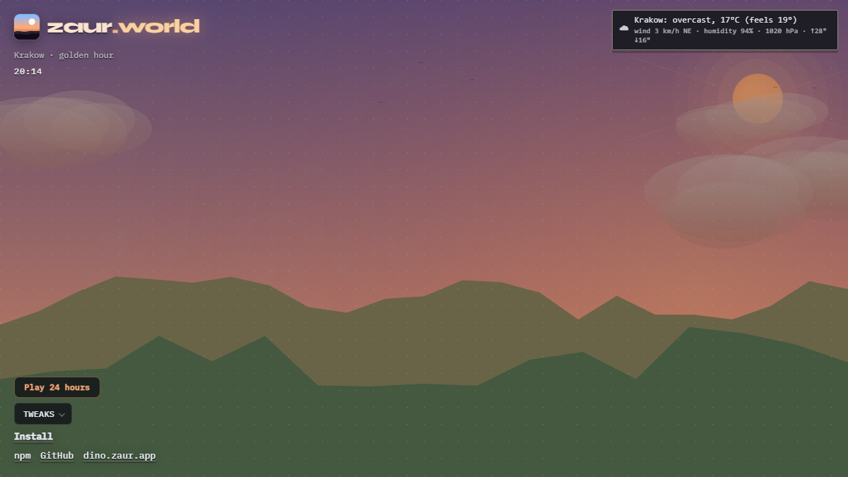
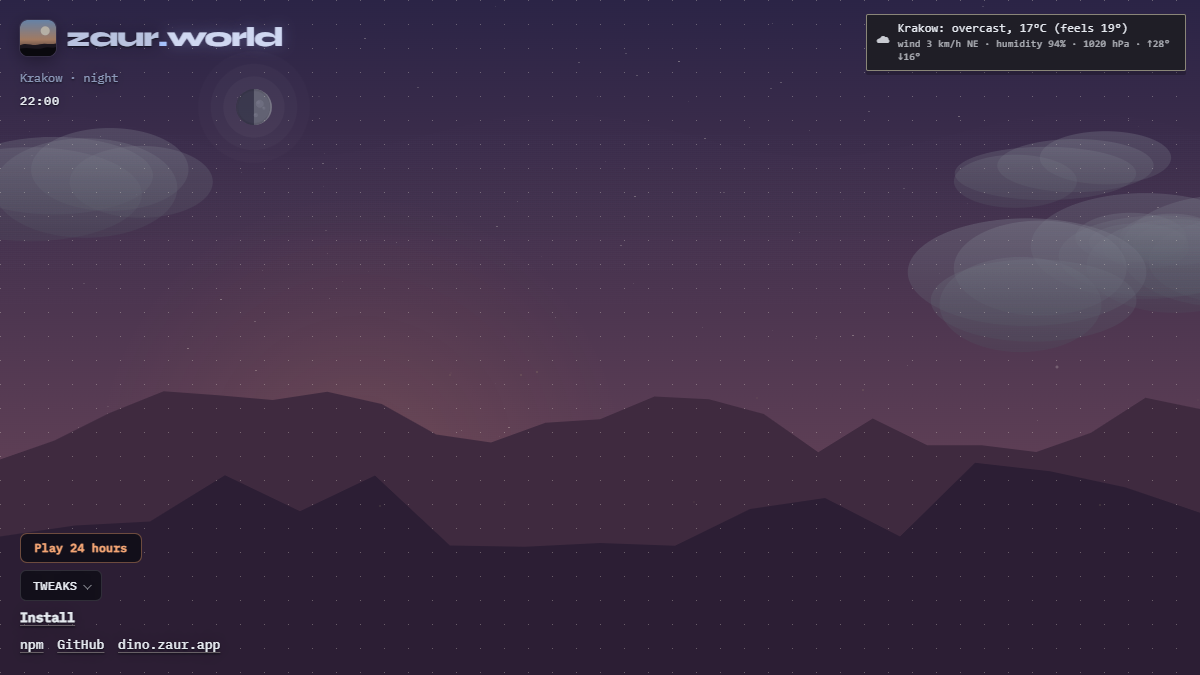
Live demo — opens on a clear, unobstructed sky with a small toggle in the corner to reveal the controls. Hit ▶ Play 24 hours for a 30-second tour through dawn, golden hour, dusk, and the night sky, with the hourly forecast riding along beside the clock — or scrub the day strip along the bottom edge to jump the sky to any of the next 24 hours. On a VPN, tap Use my location so the tour matches your real sky. It installs as a PWA — add it to a home screen and it opens full-screen, with the last sky still drawing when there is no network.
| Golden hour | Night |
| --- | --- |
|  |
|  |
|
What it renders
- A real day — sky colors keyed to the visitor's actual sunrise and sunset (Open-Meteo), so summer evenings stay light late and winter days end early. Sun arcs by day. The moon shows its real phase and near-side maria and keeps its real hours — a full moon rising at sunset, a quarter moon pale in the daytime sky — its lit limb turned toward the sun. At clear dusk and dawn Earth's shadow and the pink Belt of Venus climb the sky opposite the sun; under a cirrus veil the sun (or a bright moon) wears a 22° halo, with sun dogs when it is low. Fractal ridgelines fade range by range into the sky behind them.
- The real night sky — once location is known, the stars are the ~330 brightest (Yale catalog, to magnitude 3.6) at their true positions for that place and moment: Orion in winter, the Summer Triangle in July, wheeling with the sidereal clock over a faint scatter for the rest. Falls back to a decorative field until a location resolves.
- Live weather — per-visitor location (IP by default, or browser GPS with
geolocation: "prefer"/sky.relocate()— accurate even on a VPN) drives clouds (three parallax layers), rain with splashes, snow, fog, thunderstorms with lightning timed to the real 15-minute nowcast, and wind that slants rain, drives flakes sideways, and hurries the clouds. Intensity scales the whole scene: light drizzle is a veil; 100% is a sealed, slowly drifting stratus deck with no sun visible. Overcast desaturates the sky; clear days are genuinely blue, and lightly veiled ones (~10–40% real cover) show high thin cirrus filaments. Conditions stay physically coherent (warm snow melts to rain; sub-zero rain falls as snow), a 15-minute nowcast lands precipitation within a minute of its slot, and the sky catches up instantly when a backgrounded tab wakes again. - Golden hour — horizon glow, a broad warm aureole round the low sun, backlit slopes falling into warm shadow, and cloud bases lit rose from beneath at sunrise and sunset.
- Seasons and small life — birds by day (sheltering from rain, sparse in winter), fireflies on summer nights, aurora veils in deep night at high latitudes, shooting stars a few minutes apart, heat haze above 27 °C, visibility-driven mist and haze that closes in on humid days, frost that forms as the air nears its dew point, ground that stays visibly wet after rain, and snow that accumulates from the real snowfall amount and lingers while the air stays cold. Seasons flip with the visitor's hemisphere.
- A believable traffic of sky objects — airplanes with dissolving contrails by day and blinking navigation lights by night, migrating V-formations in spring and autumn, a stylized satellite train gliding over rarely at night, a rainbow when the sun meets a clearing shower, crepuscular rays (god rays) fanning down while a cloud edge crosses the sun, and shooting-star rates that spike on real meteor-shower peaks (Perseids, Geminids, Quadrantids, Lyrids, Eta Aquariids, Orionids).
- The real Venus and Jupiter — tracked from orbital elements (to a degree or two) at their true elongation from the sun: Venus bright and steady in the west after sunset or ahead of the sunrise, Jupiter crossing the sky all night near opposition, both gone near conjunction. Bats flit through the dusk on summer evenings, and a warm dome of city light sits beyond the ridge at night — brighter under overcast, the way clouds really bounce a town's light back down.
Optional extras
createWorld(canvas, {
  terrain: true,     // shape the horizon from real nearby elevations
  satellites: true,  // show the real ISS when it passes near the visitor
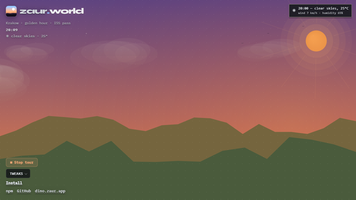
});terrainsamples elevations in a ~40 km ring around the visitor (one cached Open-Meteo call): plains get low rolling hills, alpine regions get tall jagged ridges with a third distant peak line, and coastlines flatten toward a shimmering sea band.satellitespolls wheretheiss.at (keyless) every two minutes and, when the ISS is genuinely within ~1200 km, plays a bright dot arcing across the night sky — the same pass you could walk outside and watch.
Zaur
The pixel dinosaur the package is named for — opt-in, off by default:
import { mountZaur } from "@nomideusz/zaur-world/zaur";

const sky = createWorld(canvas);
const zaur = mountZaur({
  // The ground line he walks on, in CSS px from the viewport top.
  floorY: () => window.innerHeight - 8,
  // The sky's hour drives his routines — he naps at night, patrols by day.
  skyHour: () => new Date().getHours() + new Date().getMinutes() / 60,
  // Optional: give him the sky's weather and he lives in it.
  weather: () => sky.conditions(),
});
// zaur.destroy() to unmount
He walks a fixed full-viewport overlay canvas of his own (#zaur-canvas,
pointer-events: none — clicks pass through, though poking his pixels gets
a reaction). With weather wired he gets soaked in rain and drips dry,
pulls on a sweater below 5 °C, collects a crest of snow while it flakes,
startles at the first thunderclap, and heads home when it pours.
Usage
import { createWorld } from "@nomideusz/zaur-world";

const canvas = document.querySelector("canvas")!;
const sky = createWorld(canvas);

// later, e.g. on component unmount:
sky.destroy();
No build step — script tag / CDN
The auto entry mounts a full-viewport sky behind the page on its own:
<script>
  window.zaurWorldConfig = { terrain: true, satellites: true }; // optional
</script>
<script type="module" src="https://esm.sh/@nomideusz/zaur-world/auto"></script>
It adopts a <canvas data-zaur-world> if one exists (or the canvas CSS
selector from the config), otherwise it creates a fixed canvas at
z-index: -1. The handle is exposed as window.zaurWorld.
The canvas must be sized by CSS — the device-pixel scaling and render loop are handled for you:
canvas {
  position: fixed;
  inset: 0;
  width: 100%;
  height: 100%;
  height: 100lvh; /* mobile: don't resize when the URL bar collapses */
  z-index: 0;
  pointer-events: none;
}
Content layered above the sky reads best on a translucent panel. The sky
writes CSS variables onto document.documentElement so your UI can live
under the weather:
.card {
  background: rgba(20, 20, 26, calc(0.55 + var(--zw-wetness, 0) * 0.15));
  backdrop-filter: blur(calc(10px + var(--zw-frost, 0) * 8px));
  box-shadow: inset 0 0 calc(var(--zw-frost, 0) * 16px)
    rgba(200, 220, 255, calc(var(--zw-frost, 0) * 0.3));
}

/* Optional rain streaks */
.card::after {
  content: "";
  position: absolute;
  inset: 0;
  opacity: calc(var(--zw-rain, 0) * 0.5);
  background: repeating-linear-gradient(
    -18deg,
    transparent 0 7px,
    rgba(180, 200, 230, 0.08) 7px 8px
  );
  pointer-events: none;
}

html[data-zw-mood="golden"] .headline { color: #ffe0c2; }
html[data-zw-day="0"] .meta { color: rgba(200, 210, 240, 0.75); }
Variables: --zw-daylight, --zw-dusk, --zw-wetness, --zw-snow-cover,
--zw-frost, --zw-rain, --zw-snow, --zw-glow, --zw-wind, --zw-cloud.
Attributes: data-zw-mood, data-zw-precip, data-zw-day, data-zw-moments.
Pass atmosphereRoot: null to disable, or onAtmosphereChange to react in JS.
Hero background
The sky works well as a living hero-section backdrop. Scope the canvas to the section instead of the viewport, and dim it with plain CSS so text stays readable:
.hero {
  position: relative;
}
.hero canvas {
  position: absolute;
  inset: 0;
  width: 100%;
  height: 100%;
  z-index: 0;
  pointer-events: none;
  opacity: 0.8; /* dim to taste */
}
.hero > * {
  position: relative;
  z-index: 1;
}
Scenes
Jump straight to a moment worth showing — anchored to the visitor's real sun times, so "golden" is their golden hour:
sky.preview("golden"); // "dawn" | "noon" | "golden" | "dusk" | "night"
sky.preview("storm");  // or a weather look:
                       // "clear" | "rain" | "storm" | "snow" | "fog" | "overcast"
sky.preview(null);     // back to the live clock and live weather
Weather looks are layered over live conditions and are independent of the clock, so they combine — snow at night:
sky.preview("night");          // jump the clock to night…
sky.setWeatherPreview("snow"); // …then layer snow over it
Dial individual climate fields on top of live weather or a preview — intensity, temperature, wind, clouds, precip, fog, thunder:
sky.setWeatherPreview("storm");
sky.setWeatherOverride({ intensity: 1, windSpeed: 45 }); // sealed overcast gale
sky.setWeatherOverride(null); // clear field overrides
normalizeWeather() (also applied automatically) keeps impossible combos
coherent — e.g. snow above ~1 °C becomes rain; rain below freezing becomes
snow.
Forecast
The weather fetch also brings back ~48 hours of hourly forecast. Pair
setForecastHour with setTime to show the weather an hour will actually
bring — the demo's "Play 24 hours" tour is exactly this:
sky.setTime(() => hourAsDate(18));  // glide the clock to 18:00…
sky.setForecastHour(18);            // …and the sky rains if 18:00 will rain
sky.setForecastHour(null);          // back to current conditions
sky.forecast();                     // raw ForecastHour[] for your own UI
Hours earlier than now roll into tomorrow, so sweeping a full day from the
current hour always shows the coming 24 hours. While a forecast hour is
active the built-in weather card follows along — "18:00 — raining, 24°C"
with precip chance, wind, and humidity — and stays on screen until you pass
null. Building your own readout instead? formatForecastLine(hour, wx),
formatForecastDetails(wx), and weatherIcon(wx) are exported.
The sky clock and forecast slots use the location's timezone (from
Open-Meteo), not the browser TZ — so a 24h tour stays coherent under VPN.
Use sky.localHour() when starting your own sweep.
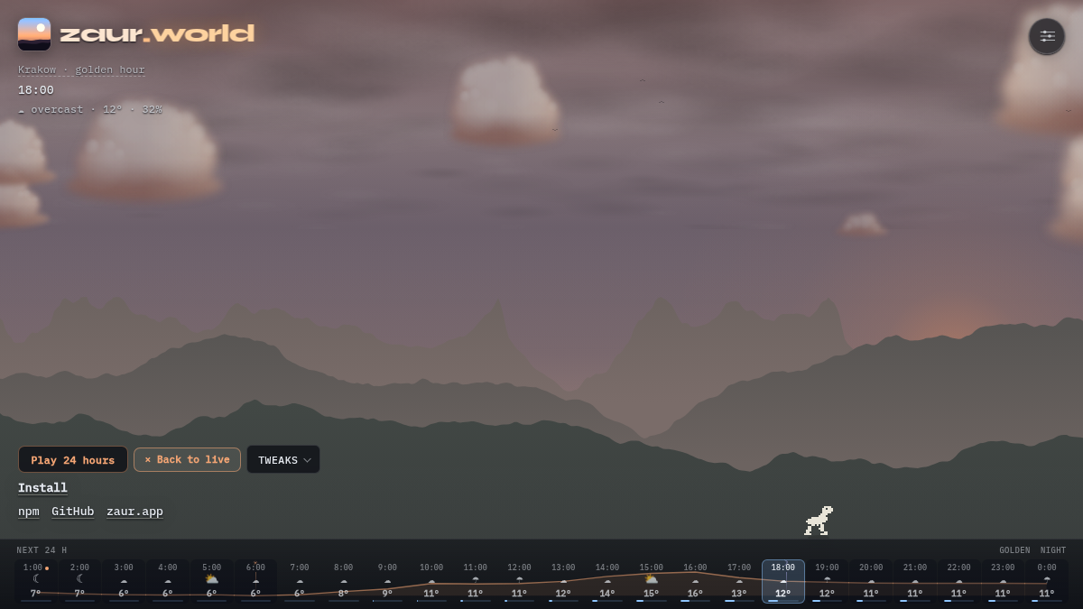
The demo turns this API into a day strip — one cell per coming hour with icon, temperature, and precip-probability meter, a temperature curve across the day, sunrise/sunset marks, and shaded night hours. Click or drag to pin the sky to that hour:
Current conditions carry detail too: humidity, cloudCover,
cloudCoverHigh, pressureMsl, windDirection, windGusts, and weatherCode (feed it to
describeWeather()). Intensity scales continuously from precip mm (and
WMO code), and forecast hours interpolate intensity, cloud cover, humidity,
and precip chance between slots.
Location (VPN-safe)
createWorld(canvas, { geolocation: "prefer" }); // GPS first, IP fallback

await sky.relocate();           // re-ask for GPS; reverse-geocodes the city
await sky.setGeo({ lat: 50.06, lon: 19.94, city: "Kraków" }); // pin a place
await sky.setGeo(null);         // clear pin → re-detect
sky.city();                     // "Kraków" (from IP, GPS, or reverse-geocode)
sky.locationSource();           // "gps" | "ip" | "fixed" | …
sky.locationHint();             // VPN/mismatch tip for your UI, or null
locationHint() is non-null when the forecast timezone disagrees with the
device clock (typical VPN). The demo pulses the place name in that case —
clicking it opens the location panel: GPS, city search, or a preset city
(?lat=&lon=&city= shareable).
Options
createWorld(canvas, {
  // Show the small "Krakow: clear skies, 24°C" status card.
  weatherCard: { parent: document.body, position: "top-right" },

  // Foreground graph-paper dot grid; null disables it.
  gridColor: "rgba(232, 228, 216, 0.06)",

  // Fixed location — skips IP geolocation.
  geo: { lat: 50.06, lon: 19.94, city: "Kraków" },

  // React to weather without polling.
  onConditionsChange(wx) {
    document.body.classList.toggle("theme-day", wx.isDay);
  },

  // Performance preset: "auto" | "low" | "high" (default "auto").
  quality: "auto",

  // Pause rendering while the tab is hidden (default true).
  pauseWhenHidden: true,

  // Manual pause/resume also available: sky.pause() / sky.resume()

  // Day birds + migrating flocks, dusk bats, summer fireflies (all default true).
  birds: true,
  bats: true,
  fireflies: true,

  // Prefer browser GPS over IP (real location under VPN). Opt-in.
  // Also: "fallback" (IP first), or sky.relocate() after mount.
  geolocation: "prefer",

  // Wall clock override for demos and screenshots.
  time: () => new Date("2026-07-12T19:30:00"),

  // Bring your own weather (disables all network calls).
  weather: () => ({
    cloudiness: 1,        // 0 none · 1 scattered · 2 overcast
    precipitation: "rain", // "none" | "rain" | "snow"
    intensity: 0.6,        // 0..1
    thunder: false,
    fog: false,
    isDay: true,
    windSpeed: 18,         // km/h
    temperatureC: 21,
    latitude: 50.1,        // optional; flips seasons south of the equator
    sunriseH: 4.5,         // local decimal hours, null = built-in defaults
    sunsetH: 21.0,
  }),
});
React
import { useZaurWorld } from "@nomideusz/zaur-world/react";

export function Sky() {
  const { canvasRef, worldRef } = useZaurWorld({ terrain: true, satellites: true });
  // Options apply at mount; later tweaks go through worldRef.current
  // (preview, setTerrain, capture, …) or remount with a new key.
  return <canvas ref={canvasRef} style={{ position: "fixed", inset: 0 }} />;
}
Or without the hook:
import { useEffect, useRef } from "react";
import { createWorld } from "@nomideusz/zaur-world";

export function Sky() {
  const canvasRef = useRef<HTMLCanvasElement>(null);

  useEffect(() => {
    const canvas = canvasRef.current;
    if (!canvas) return;
    const sky = createWorld(canvas, { terrain: true });
    return () => sky.destroy();
  }, []);

  return <canvas ref={canvasRef} style={{ position: "fixed", inset: 0 }} />;
}
Subpath imports
import { deriveConditions } from "@nomideusz/zaur-world/weather";
import { warpHour, solsticeWarmth } from "@nomideusz/zaur-world/solar";
Snapshot
const sky = createWorld(canvas);
const png = sky.capture("image/png");

// Shareable still with place · time · mood burned in:
const moment = sky.captureMoment();
console.log(moment.caption); // "Kraków · 21:14 · golden hour"
// moment.dataUrl → download or share
Cinematic demo links work the same way — open ?wx=snow or
?eclipse=solar&city=Tokyo&lat=35.68&lon=139.69 on the live demo, or use
the Golden / Night buttons on the day strip to jump the sky to the
moment worth seeing.
Reacting to conditions elsewhere in your UI:
const sky = createWorld(canvas, {
  onConditionsChange(wx) {
    document.body.classList.toggle("theme-day", wx.isDay);
  },
});
World and WeatherClient are also exported individually if you want to own
the render loop yourself.
Network & privacy
With default options the package calls two public endpoints from the
visitor's browser: geojs.io once per session for
approximate IP location (cached in localStorage), and
Open-Meteo every 15 minutes for current conditions
and sun times. terrain: true adds one cached Open-Meteo elevation call;
satellites: true polls wheretheiss.at every two
minutes. No keys, no cookies, nothing sent beyond the IP request itself.
Pass your own weather function to make zero network calls.
See CHANGELOG.md for version history.
localStorage keys used when caching is enabled (default): zaur-world-geo,
zaur-world-terrain. Pass cache: false to disable persistence.
Development
pnpm install
pnpm test          # unit tests
pnpm run demo:dev  # local demo
License
MIT