
bad-map
v0.12.0
Published
A semantic low-resolution Braille basemap for MapLibre GL JS

Maintainers
 niko.dellic
Readme
bad-map
A semantic low-resolution cartography toolkit for MapLibre GL JS.
bad-map renders vector-tile meaning instead of pixelating an existing map.
Coarse area fills, ranked square-dot lines, scalar data, and labels are composed
independently, which leaves ordinary MapLibre and deck.gl layers crisp and
interactive. Greyscale is the default; full color remains.
Gallery
Every view below uses the semantic low-resolution renderer without fog, fisheye, or vignette effects. Data visualizations retain their own colors when the cartography is greyscale.
Theme and color modes
| Dark theme | Light theme |
| ----------------------------------------------------------------------------------------------------------------------------------------------------------------------------------------------------------------- | -------------------------------------------------------------------------------------------------------------------------------------------------------------------------------------------------------------- |
| 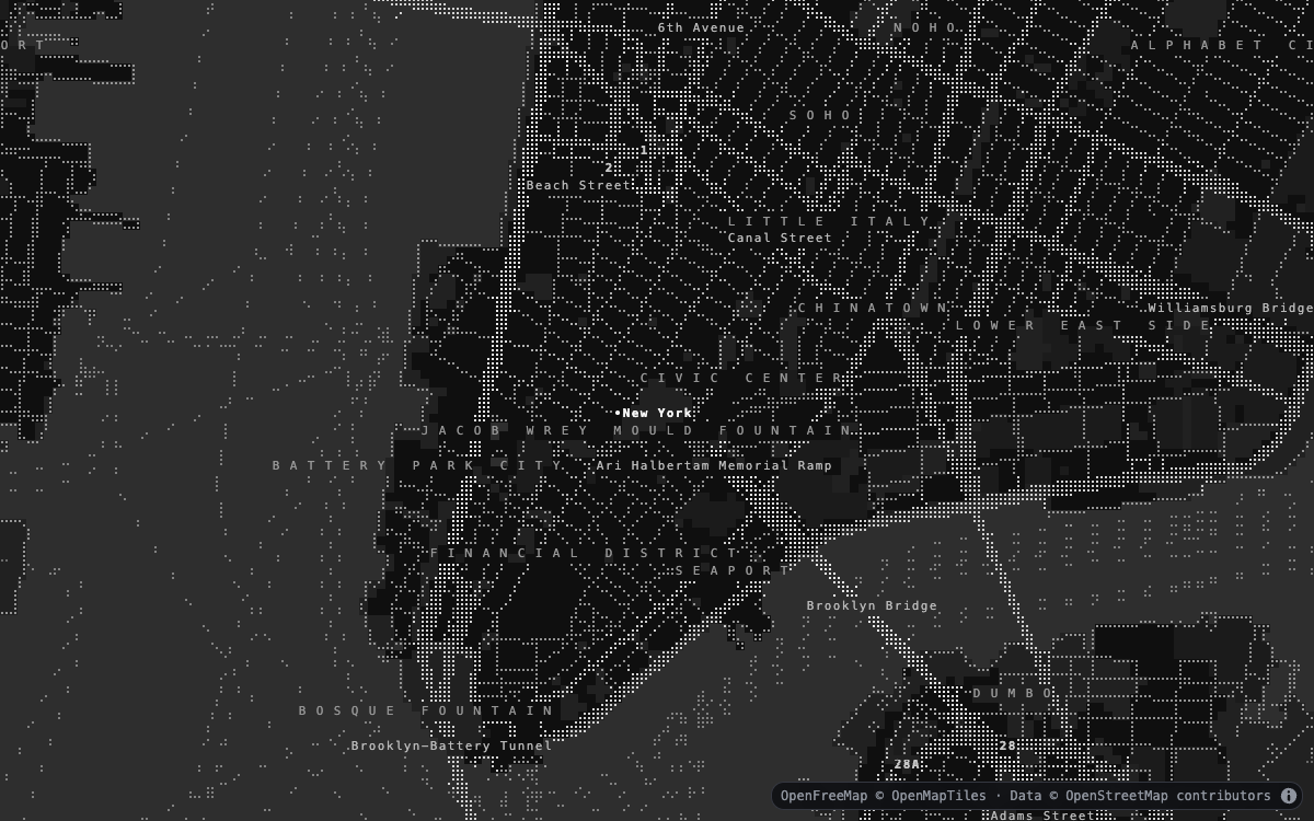 Dark · greyscale — streets and labels |
 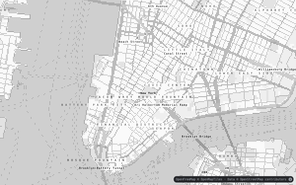 Light · greyscale — the same camera and detail |
|
Light · greyscale — the same camera and detail |
| 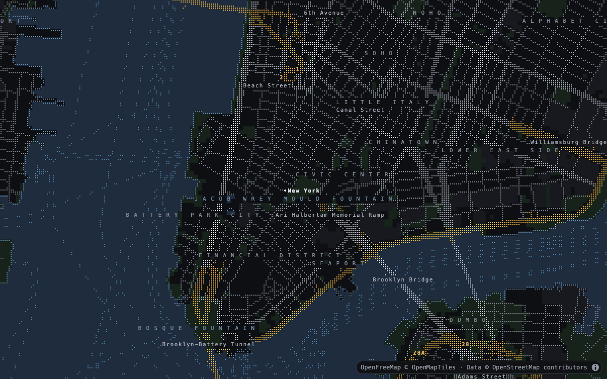 Dark · full color — semantic fills and ranked linework |
 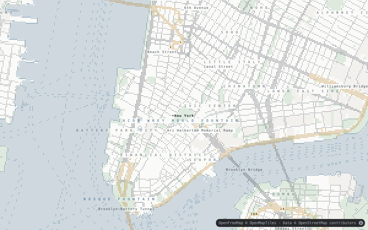 Light · full color — the same camera and detail |
Cartography and camera
| Regional and coastal detail | Dense urban detail |
| ----------------------------------------------------------------------------------------------------------------------------------------------------------------------------------------------------------------------------------- | -------------------------------------------------------------------------------------------------------------------------------------------------------------------------------------------------------- |
| 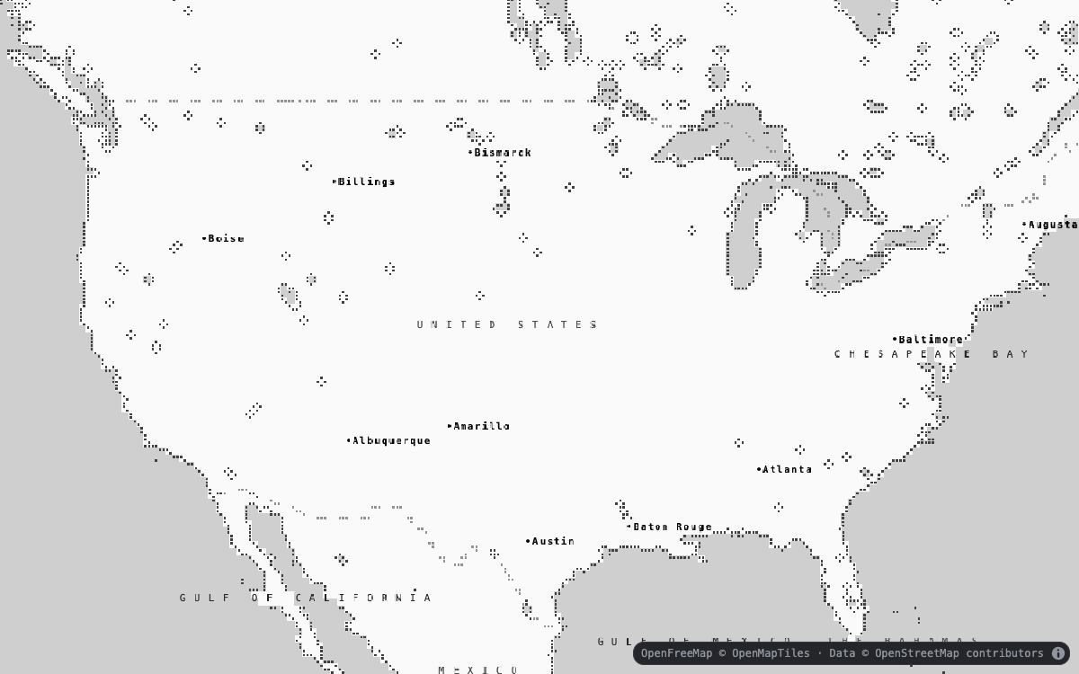 Regional political boundaries — low-zoom continental view |
 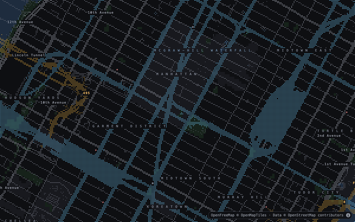 Urban transit — high-zoom streets, transit, and labels |
|
Urban transit — high-zoom streets, transit, and labels |
| 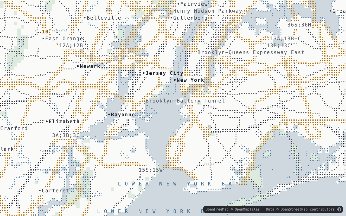 Marine and land use — 12 × 24 configurable cells |
 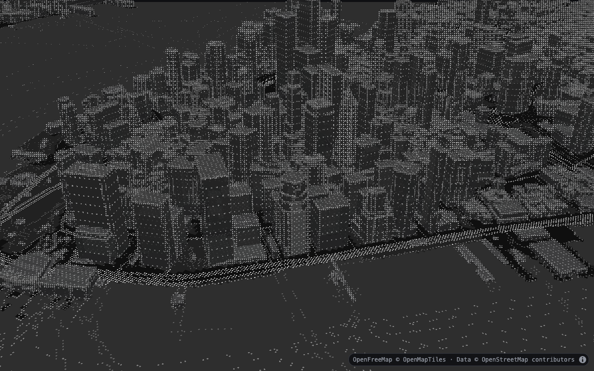 Inked 3D buildings — pitched surface projection |
Data layers
| Scalar and animated data | General GeoJSON |
| ------------------------------------------------------------------------------------------------------------------------------------------------------------------------------------------------------------------ | ---------------------------------------------------------------------------------------------------------------------------------------------------------------------------------------------------------------------------------------------------------------------------- |
| 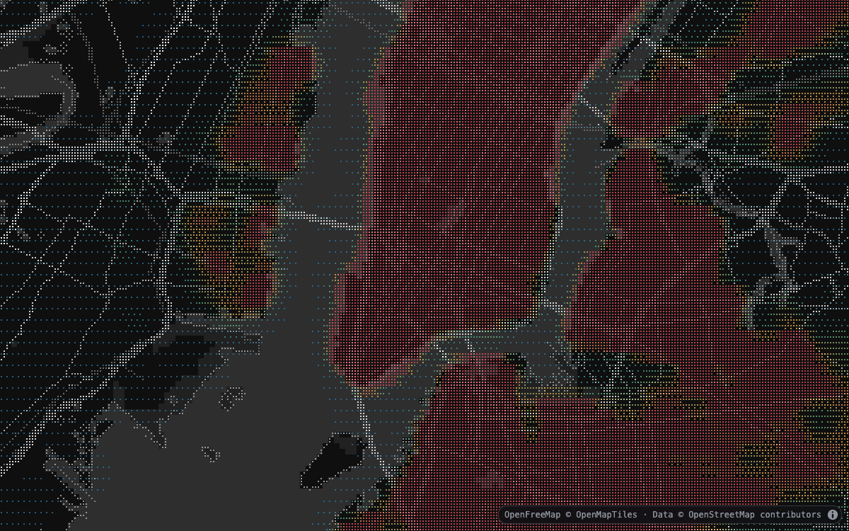 Heatmap — colored density over greyscale cartography |
 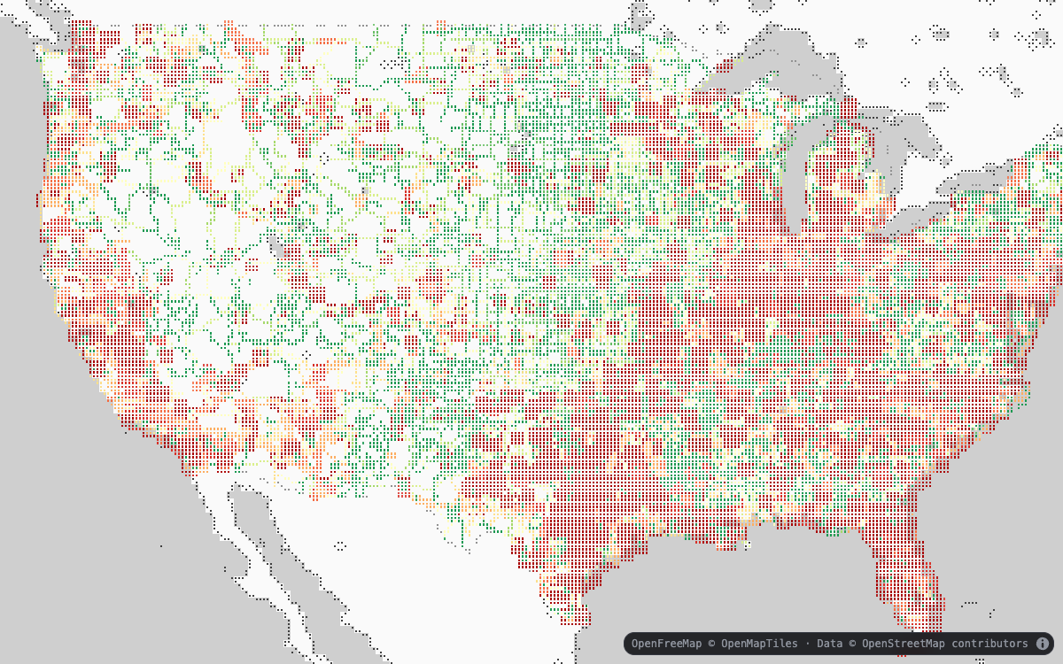 Highway safety — data-driven path color and width |
|
Highway safety — data-driven path color and width |
| 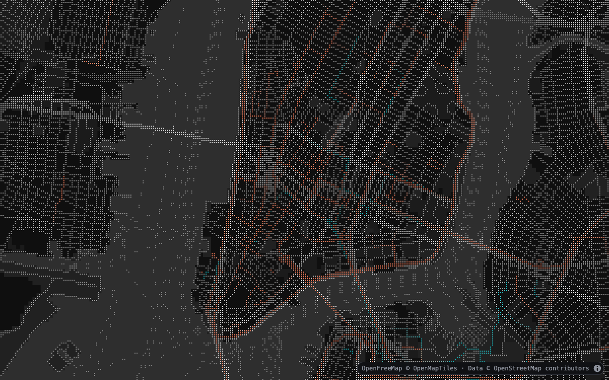 Trips — a deterministic frame from animated trails |
 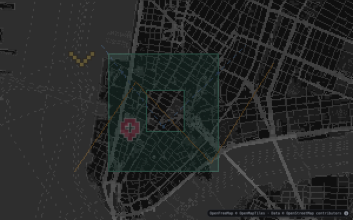 Geometry and waypoints — points, paths, polygon holes, locator, and caret symbols |
See it in motion

Animated trips

Pixelated heatmap
Install
npm install bad-mapMapLibre GL JS is a required peer dependency and is installed automatically by
npm 7 and newer. Package managers that do not install peer dependencies should
install maplibre-gl@^6 explicitly. The default keyless source is OpenFreeMap.
bad-map is safe to import during server rendering, but it is a browser
renderer rather than a server-side map renderer. Construct the MapLibre map and
call addTo() from client-side code after the map container mounts; those
operations require the DOM, a canvas, WebGL 2, and Web Workers.
MapLibre GL JS 6 uses a separate ESM worker. Vite applications must configure its bundled URL once before creating a map:
import { setWorkerUrl } from "maplibre-gl";
import maplibreWorkerUrl from "maplibre-gl/dist/maplibre-gl-worker.mjs?worker&url";

setWorkerUrl(maplibreWorkerUrl);
Other bundlers should follow MapLibre's ESM worker setup.
Quick start
Give the MapLibre container an explicit size:
<div id="map"></div>
<style>
  html,
  body,
  #map {
    width: 100%;
    height: 100%;
    margin: 0;
  }
</style>
import { Map } from "maplibre-gl";
import { LowResBasemap, streets, transit } from "bad-map";
import "maplibre-gl/dist/maplibre-gl.css";
const map = new Map({
container: "map",
center: [-74.006, 40.7128],
zoom: 14,
style: { version: 8, sources: {}, layers: [] },
});
const basemap = new LowResBasemap({
source: { tileJSON: "https://tiles.openfreemap.org/planet" },
layers: [streets(), transit({ enabled: false, priority: 20 })],
colorMode: "greyscale",
cell: { width: 8, height: 16, dotSize: 2 },
});
await basemap.addTo(map);
basemap.setLayerVisible("transit", true);Options and defaults
| Option | Default | Purpose |
| ------------------------ | ------------------------------------------ | -------------------------------------------------- |
| source | OpenFreeMap | Shorthand for the named base MVT source |
| sources | { base: source } | Named OpenMapTiles-compatible TileJSON sources |
| layers | [streets()] | Serializable semantic pack descriptors |
| theme | "dark" | Built-in theme name or complete custom theme |
| colorMode | "greyscale" | Basemap and label color composition |
| projectionMode | "surface" | Geographic surface or fixed screen lattice |
| camera | Surface rotation and pitch, maxPitch: 60 | Map interaction policy |
| buildings3D | Visible fill + edges, dots off | Low-resolution OpenMapTiles building extrusions |
| fog | Dithered and visible | Surface-edge atmosphere |
| heatmap / dataLayers | Empty and hidden | Package-owned visualization layers |
| cell | 8 × 16, dotSize: 2 | CSS-pixel character and dot geometry |
| locale | "en" | Preferred label language |
| labels | Visible and billboarded | Label visibility and surface alignment |
| attribution | true | Install deduplicated source attribution |
| featureInteraction | true | Hover and click ownership queries |
| enforceNorthUp | false | Disable host-map rotation and pitch while attached |
| maxCachedTiles | 96 | Shared fallback tile-cache budget |
| renderThrottleMs | 70 | Worker refresh cadence during movement |
| workers | Bundled workers | Raster and data worker factory overrides |
| workerFactory | Bundled semantic worker | Deprecated alias for workers.raster |
Workers and content security policy
The default distribution embeds the semantic worker in the main bundle and
creates the data worker only when a visible package data layer needs it. This
zero-asset setup requires blob: in worker-src:
worker-src 'self' blob:;
connect-src 'self' https://tiles.openfreemap.org;
img-src 'self' data: blob:;
Applications with a strict worker-src 'self' policy can use the package's
self-contained worker entry points instead. Vite emits them as same-origin
assets with ?url:
import rasterWorkerUrl from "bad-map/workers/raster?url";
import dataRasterWorkerUrl from "bad-map/workers/data-raster?url";

const basemap = new LowResBasemap({
  workers: {
    raster: () =>
      new Worker(rasterWorkerUrl, {
        type: "module",
        name: "bad-map-raster",
      }),
    data: () =>
      new Worker(dataRasterWorkerUrl, {
        type: "module",
        name: "bad-map-data-raster",
      }),
  },
});
For other bundlers, emit or copy the bad-map/workers/raster and
bad-map/workers/data-raster package exports to same-origin URLs, then return
module workers for those URLs from the two factories. MapLibre's own worker is
configured separately using its documented setup.
Network behavior
Calling addTo() fetches the configured TileJSON and visible MVT tiles. With no
source option, requests go to https://tiles.openfreemap.org/planet; the
package itself contains no analytics. OpenFreeMap's public
service is keyless and permits commercial use, but
does not provide an SLA. Production hosts can replace it with any compatible
OpenMapTiles source or a self-hosted endpoint. Keep attribution enabled, or
provide equivalent visible attribution yourself.
Browser support
The supported baseline is an evergreen browser with WebGL 2, module workers, and Web Mercator support. Chromium runs the full packed-package rendering, deferred data-worker, and strict-CSP checks. Firefox and WebKit execute the packed module and both worker runtimes without relying on headless WebGL. Rendering remains client-only even though importing the package during SSR is supported.
Layer ordering
Seven stable IDs divide the render stack:
basemap.layerIds.base; // fills and low-resolution linework
basemap.layerIds.buildings; // optional dotted or native 3D buildings
basemap.layerIds.data; // low-resolution data compositor
basemap.layerIds.markers; // marker boundary
basemap.layerIds.labels; // package labels
basemap.layerIds.fog; // atmospheric fog over all map content
basemap.layerIds.interaction; // top interaction boundary
Insert a native visualization immediately below the marker boundary to keep it above the cartography and below labels:
map.addLayer(dataLayer, basemap.layerIds.markers);Color modes only affect basemap cartography and labels. Native visualization layers and the package data compositor keep their own palettes.
Semantic packs and sources
Built-in serializable descriptors are available for streets, transit,
topographic, weather, political, marine, and landuse. Each descriptor
selects source layers and a worker-side adapter; no callbacks cross the worker
boundary.
import { LowResBasemap, streets, topographic, weather } from "bad-map";

const basemap = new LowResBasemap({
  sources: {
    base: { tileJSON: "/tiles/base.json", maxCachedTiles: 96 },
    terrain: { tileJSON: "/tiles/terrain.json" },
    forecast: {
      tileJSON: "/tiles/weather.json",
      timeKey: "2026-08-19T12:00Z",
      maxConcurrentRequests: 4,
      retryCount: 2,
    },
  },
  layers: [
    streets(),
    topographic({ source: "terrain", priority: 10 }),
    weather({ source: "forecast", priority: 30 }),
  ],
});

basemap.setSourceTime("forecast", "2026-08-19T13:00Z");
Tile templates may contain {time}. Numeric polygon properties declared by a
pack are quantized into a compact scalar texture; the built-in weather and
topographic factories provide defaults that can be overridden through their
numeric option. Sources currently need MVT data, with OpenMapTiles property
conventions for the built-in adapters.
LowResSource.request supplies serializable headers, credentials, mode,
and referrerPolicy values to TileJSON and tile requests made by the semantic
worker. Dotted buildings share that worker request configuration. Native
MapLibre building layers use MapLibre's own source and request configuration.
Pixelated data layers
The demo compares two renderers using 100,000 weighted NYC Uber pickup locations from the public deck.gl screen-grid dataset.
A standard MapLibre heatmap can be inserted below the marker boundary. It stays smooth and remains outside package theme and greyscale changes:
map.addLayer(nativeHeatmapLayer, basemap.layerIds.markers);Package-owned visualizations use an ID-based registry and a dedicated data
worker. Heatmaps, GeoJSON, and animated trips render through bad-map-data;
waypoints render through bad-map-markers. Both passes sit below labels and
retain their palettes when the basemap switches to greyscale.
The heatmap accepts compact
[longitude, latitude, weight] triplets. Density is accumulated in the worker,
quantized to one byte per cell, and expressed through ordered square-dot
dithering:
basemap.setHeatmap({
  data: pickupLocations,
  visible: true,
  radius: 36,
  intensity: 1,
  maxDensity: 192,
  opacity: 0.76,
  palette: [
    [40, 109, 155],
    [87, 173, 133],
    [239, 178, 75],
    [226, 76, 91],
  ],
});
maxDensity: 0 normalizes against the current view. A fixed positive maximum
is preferable for comparisons and animated data because it prevents the color
domain from changing while panning. Custom palettes remain unchanged when the
basemap switches between color and greyscale. Use setHeatmapData(),
setHeatmapVisible(), or
clearHeatmap() for runtime updates. These compatibility methods operate
through the same registry.
New applications can create multiple data layers directly:
basemap.setDataLayer({
  id: "route",
  type: "geojson",
  data: routeGeoJSON,
  order: 20,
  pickable: true,
  line: {
    color: (feature) =>
      feature.properties?.closed ? [230, 76, 91] : [87, 173, 133],
    width: 3,
  },
  fill: { color: [87, 173, 133], opacity: 0.35 },
});

basemap.setDataLayer({
  id: "destination",
  type: "waypoint",
  order: 100,
  style: "caret",
  size: 32,
  data: [{ id: "office", position: [-74.006, 40.7128] }],
});
Waypoint layers support locator targets and downward caret glyphs. Set
style and CSS-pixel size on the layer, or override either value on an
individual waypoint. Both shapes stay aligned to the square-dot lattice and
retain a contrasting halo.
GeoJSON supports points, lines, polygons, their multi-geometry variants, and
GeometryCollection data. Point, line, fill, and outline styles may be constants
or accessors. Accessors run once on the main thread; only normalized geometry
and style values cross the worker boundary. Invalid individual records are
skipped with typed, nonfatal data errors that include the layer ID.
Trips use paths with matching per-vertex timestamps:
basemap.setDataLayer({
  id: "vehicles",
  type: "trips",
  data: trips,
  playing: true,
  currentTime: 0,
  loopLength: 1800,
  trailLength: 180,
  speed: 1,
  width: 2,
});

basemap.setTripsPlayback("vehicles", { playing: false, currentTime: 900 });
basemap.seekTripsPlayback("vehicles", 720, { playing: false });
basemap.stepTripsPlayback("vehicles", 15);

basemap.updateDataLayer("vehicles", {
  type: "trips",
  width: 3,
  opacity: 0.8,
});
seekTripsPlayback and stepTripsPlayback support video-style timelines
without rebuilding or resending trip geometry. Seeking clamps to the loop by
default; pass { wrap: true } for circular stepping. The optional playing
flag lets a control pause while dragging and restore its previous playback
state on release.
Use setDataLayer, updateDataLayer, removeDataLayer,
setDataLayerVisible, getDataLayers, and clearDataLayers to manage the
registry. Common visibility, opacity, ordering, and picking updates use compact
worker patches instead of resending geometry. Static layer rasters are reused
while trips update at a 30 fps worker cadence; the latest texture continues to
reproject at display refresh rate. queryDataFeatures and the
datafeatureenter, datafeatureleave, and datafeatureclick events expose the
winning dot owner independently from basemap feature queries. Input URLs remain
the application's responsibility; the package accepts parsed data and has no
deck.gl runtime dependency.
Data picking is independent from basemap feature picking:
basemap.on("datafeatureclick", ({ feature }) => {
  console.log(feature.layerId, feature.featureId, feature.properties);
});

const features = basemap.queryDataFeatures({ x: 320, y: 180 });
Camera modes
surface is the default low-resolution 3D mode. It starts top-down at the
host map's current pitch; enabling buildings does not change that camera. The
semantic frame is placed on a flat Web Mercator plane and transformed with
MapLibre's public custom-layer camera matrix, so dots foreshorten during pitch
and orbiting while labels billboard to the viewport by default. Its worker
frame is fitted to the complete camera ground footprint. A second bounded
full-zoom frame covers the near and central ground, so changing pitch does not
change the semantic zoom or lattice density; only the compressed far field
uses the coarser coverage frame.
Pitch can be disabled independently with camera: { pitch: false }.
const basemap = new LowResBasemap({
  camera: { rotation: true, pitch: true, maxPitch: 70 },
});

// Restore map-aligned, foreshortened labels when that is the desired style.
basemap.setLabelsBillboard(false);
The same choice can be made at construction with
labels: { visible: true, billboard: false }. The boolean labels shorthand
continues to control visibility.
Optional atmospheric fog hides the finite surface edge as the map approaches
the horizon. Regular fog uses a smooth blend; dithered fog uses a 4×4 ordered
pattern anchored to CSS pixels, so its visual scale is stable on retina
displays. Fog is inactive in screen mode and eases in over the first 20 degrees
of pitch. Fog defaults to enabled in the dithered style. Set fog: false or
select disabled in the demo to turn it off. In the demo, fog is controlled
exclusively from Display → Atmosphere in the side pane.
The demo also adds its own dithered screen-space vignette above the map. This overlay is not exported by the package. Its dedicated FX-tab controls adjust how far the fade reaches into the viewport, choose a screen-rectangle or aspect-ratio oval base, morph either base toward a true circle, select linear, smooth, or edge-weighted falloff, and tune opacity. At zero circularity, the rectangle base uses equal-distance contours from all four edges and corners. The default linear falloff uses a 64-level 8×8 ordered pattern. The falloff controls only pixel coverage; selected dither pixels use the configured opacity. Keeping coverage and pixel alpha independent avoids accidentally squaring the gradient and makes the optical fade span the full configured reach. It reaches 100% opacity at the viewport edge. Its dither color follows the composed theme ground by default, or can be replaced with an explicit color that remains unchanged across theme and greyscale updates.
The FX tab also includes an optional demo-only fisheye pass. It applies the
same aspect-corrected radial polynomial used by draaimolen's post-processing
effect to the completed map canvas while leaving HTML controls untouched.
Broad curvature (k1) controls the r² bend that begins nearer the center,
while edge curvature (k2) independently controls the edge-concentrated r⁴
bend. Overall strength scales both coefficients together without changing
their relationship, and radius controls where those terms reach their
configured values. The fisheye is enabled by default, and changing it only
repaints the map; it does not request a new worker rasterization. The settings
panel starts collapsed so the map remains the initial focus.
const basemap = new LowResBasemap({
  fog: {
    visible: true,
    mode: "dithered",
    start: 0.55,
    end: 0.95,
    opacity: 1,
  },
});

basemap.setFog({ mode: "regular", color: [20, 24, 30] });
basemap.setFogVisible(false);
start and end are screen-space depth positions from the bottom/near edge
(0) to the top/far edge (1). They are independent of MapLibre's camera clip
planes. Ground-ray intersection is used only to make exposed frame boundaries
fully fogged. Without an explicit color, fog follows the active theme's
composed ground color, including greyscale changes. Fog is rendered after
package labels and the documented data slots, while controls outside the
WebGL canvas remain clear.
screen keeps dots square and locked to the viewport while pan, zoom, and
bearing changes reproject the most recent worker frame. It can be selected
explicitly when pitch is not required:
const basemap = new LowResBasemap({ projectionMode: "screen" });OpenMapTiles building heights render by default as low-resolution extrusions above the semantic surface and below application data. Interior dots default to off, leaving the three-band fill and silhouette edges:
const basemap = new LowResBasemap({
  buildings3D: { visible: true, minZoom: 14, opacity: 0.82, dots: false },
});

basemap.setBuildings3DVisible(false);
basemap.setBuildings3DAppearance({
  fill: false,
  dots: false,
  edges: true,
  edgeStrength: 1.25,
  heightScale: 1,
});
| Option | Default | Purpose |
| -------------- | ---------- | ----------------------------------------- |
| visible | true | Show buildings in surface mode |
| style | "dotted" | Low-resolution mesh or native MapLibre |
| sourceId | "base" | Named OpenMapTiles-compatible source |
| minZoom | 14 | First zoom at which buildings appear |
| opacity | 0.82 | Surface and edge opacity |
| heightScale | 1 | Height and minimum-height multiplier |
| fill | true | Draw three-band surfaces in dotted mode |
| dots | false | Draw interior surface dots in dotted mode |
| edges | true | Draw roof and corner ink in dotted mode |
| edgeStrength | 1 | CSS-pixel edge-weight multiplier |
When upgrading from 0.11.x, set buildings3D: false to retain the previous
no-buildings default. The original smooth extrusion appearance remains
available with buildings3D: { visible: true, style: "native" }.
Changing building visibility never changes projection, bearing, or pitch.
The building source defaults to the named base source and expects an
OpenMapTiles building layer with render_height, render_min_height, and
hide_3d properties. The default dotted style triangulates roofs and walls
in the semantic worker, colors them from the active theme, and wraps the same
2×4 square-dot lattice around their surfaces. Dots rotate and foreshorten with
the buildings. Three flat lighting tones separate planes, restrained dots add
surface texture, and cell-aligned roof perimeters and vertical corners restore
the building silhouettes without introducing smooth vector outlines. Fill,
dots, and edges can be enabled independently; edge-only mode retains a hidden
depth prepass so rear geometry does not show through the buildings.
The original MapLibre extrusion remains available when native rendering or host-map request handling is preferable:
const basemap = new LowResBasemap({
  buildings3D: { visible: true, style: "native" },
});
Dotted buildings use LowResSource.request; configure authorization for
native buildings through the host MapLibre map. Terrain elevation and shaped
roofs are not yet part of surface mode.
Runtime API
LowResBasemap provides:
addTo(map)andremove()setTheme(theme)andsetColorMode("color" | "greyscale")setCell(...),setLocale(...),setLabelsVisible(...),setLabelsBillboard(...), andgetLabelsBillboard()setSource(...),setSources(...), andsetSourceTime(...)setLayers(...),getLayers(), andsetLayerVisible(...)setProjectionMode(...)andsetCamera(...)setBuildings3DVisible(...),getBuildings3DVisible(),setBuildings3DAppearance(...), andgetBuildings3DAppearance()setFog(...),setFogVisible(...), andgetFogOptions()setHeatmap(...),setHeatmapData(...),setHeatmapVisible(...),getHeatmapOptions(), andclearHeatmap()setDataLayer(...),updateDataLayer(...),removeDataLayer(...),setDataLayerVisible(...),getDataLayers(), andclearDataLayers()setTripsPlayback(...),seekTripsPlayback(...),stepTripsPlayback(...),getTripsPlayback(...), andqueryDataFeatures(...)setFeatureInteractionEnabled(...),getFeatureInteractionEnabled(),setSelectedFeature(...),queryFeatures(...), andrefresh()- typed
on(...)andoff(...)event subscriptions - typed load, render, error, basemap-feature, data-feature, selection, style, layer, time, projection, 3D-building, fog, and heatmap events
Hover and persistent selection use the transferable owner texture. Query
results include sourceId and packId, and featureMatches provides a helper
for filtering those results.
Rendering pipeline
- A worker discovers named TileJSON sources, bounds concurrency, retries failures, and maintains per-source decoded LRUs.
- Enabled packs normalize and deterministically order semantic features.
- Polygons become categorical or scalar dot grids; water derives coastlines.
- A separate data worker rasterizes density, GeoJSON, trips, and locators into dot-resolution color and owner buffers.
- Integer line paths compete by semantic rank inside each character cell.
- Compact typed buffers are transferred to WebGL 2 cartography, data, and marker compositors.
- Labels are independently budgeted and rendered above consumer data.
During interaction, the latest buffers are reprojected while the worker
coalesces obsolete requests. moveend always requests an exact frame.
Constraints
- WebGL 2 and Web Mercator
- MVT sources for built-in packs
- Screen mode supports bearing but not pitch
- Surface mode is a flat-plane experimental renderer, without terrain
- Numeric data is categorical/quantized rather than a general raster engine
Attribution
Attribution from named sources is deduplicated into MapLibre's attribution control. Do not disable it unless equivalent visible attribution is supplied by the host application.
Troubleshooting
- Blank or zero-sized map: give the map container an explicit width and height before constructing MapLibre.
- Server-rendering errors: defer MapLibre map construction and
addTo()until after the client-side map container mounts. Importingbad-mapalone does not require browser globals. - Worker or CSP failures: allow
blob:workers for the default setup, or configure both same-origin worker factories as shown above. MapLibre's own worker policy is separate. - TileJSON or tile failures: confirm browser CORS access and place
serializable authorization values in
LowResSource.request. - Unsupported rendering:
bad-maprequires WebGL 2 and Web Mercator; it does not currently provide a canvas, WebGL 1, globe, or server renderer.
Development
The repository is organized by internal domain while publishing one npm package. See ARCHITECTURE.md for module boundaries and the expected extension path for new data-layer types.
npm ci
npx playwright install chromium chrome firefox webkit
npm run verify
npm run test:e2e:functional
npm run test:e2e
npm run dev
npm run verify checks formatting, types, unit tests, declarations, the
production build, and an isolated packed-package consumer. The full Playwright
suite includes platform-specific visual baselines; the functional subset is
used in CI.
Before submitting a change, read the contribution guide. Security issues should follow the security policy, not a public issue. The release checklist documents the maintainer workflow.
Useful individual commands:
npm test
npm run typecheck
npm run build
npm run api:check
npm run test:package
npm run test:e2e
See the project roadmap for implementation status and remaining production-depth work around terrain, animated fields, and dense picking.