
ethiopia-geo-boundaries
v3.0.7
Published
Vanilla SVG generator for Ethiopian administrative boundaries (ADM1-ADM3). Zero runtime dependencies.
Downloads
861
Maintainers
 habtamut
Readme
ethiopia-geo-boundaries v2
Fully offline administrative boundary data for Ethiopia.
Zero network calls · Works forever · Vue 3 / Nuxt 3 ready Features: Interactive drill-down (Region -> Zone -> Woreda), highly accessible, and handles contested borders cleanly.
🌍 Region Level
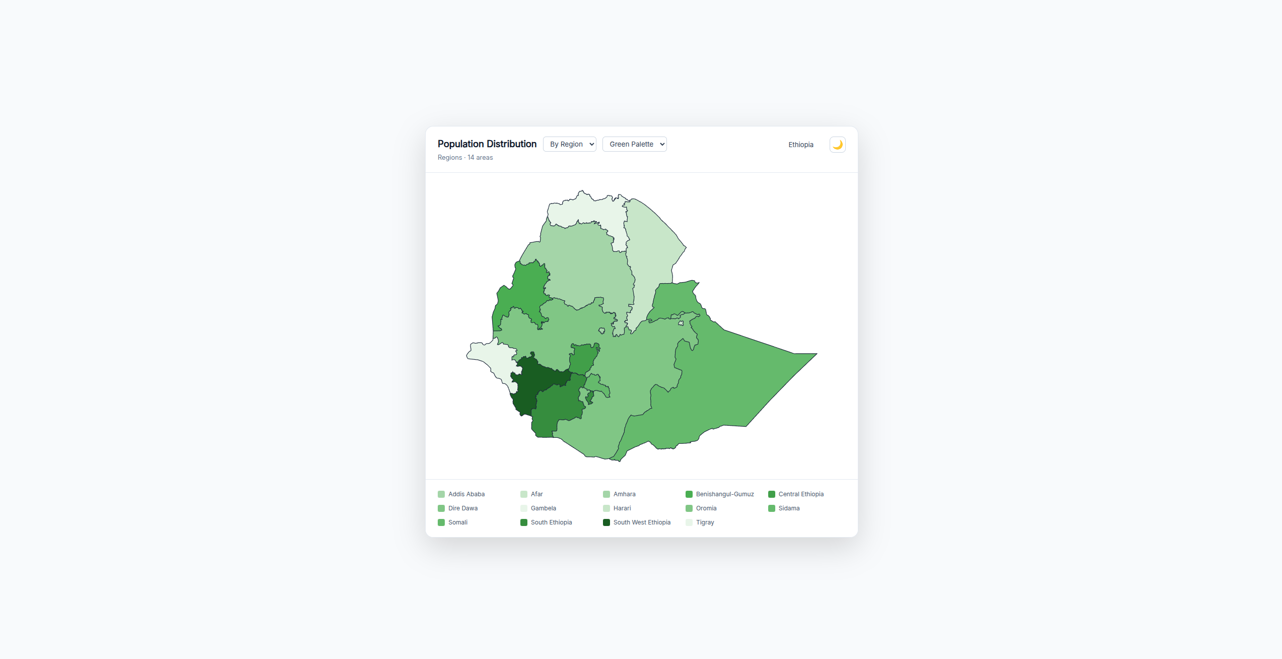
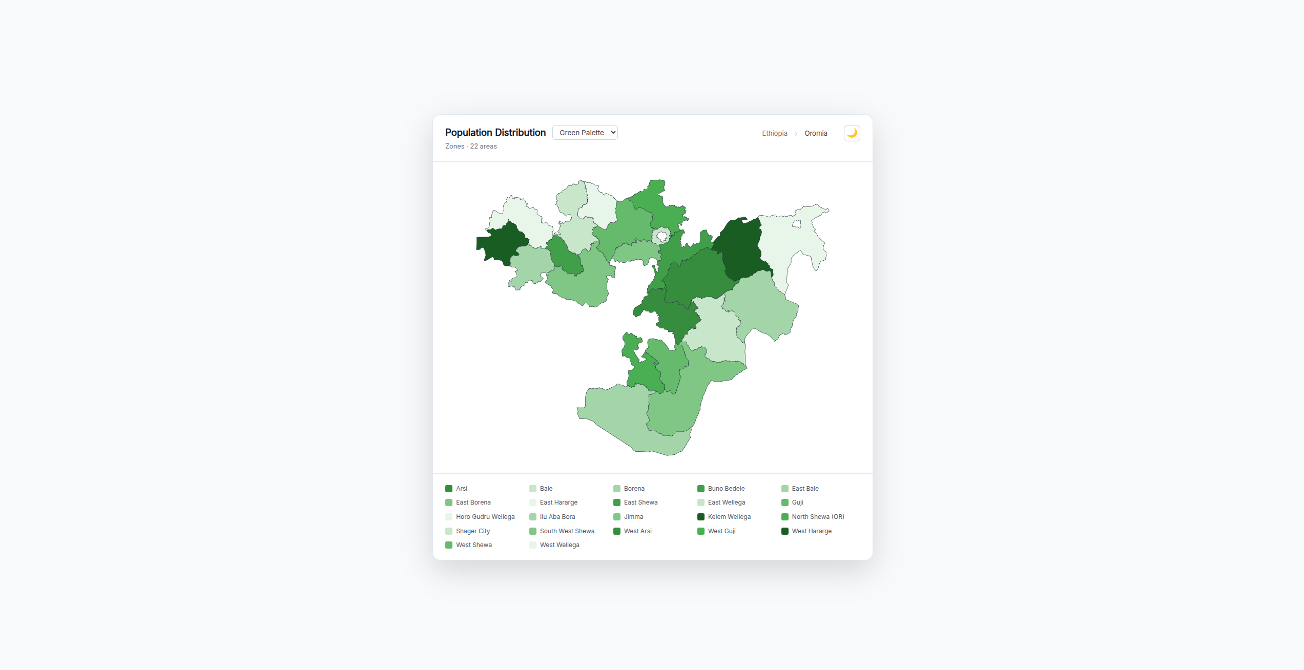
📍 Zone Level
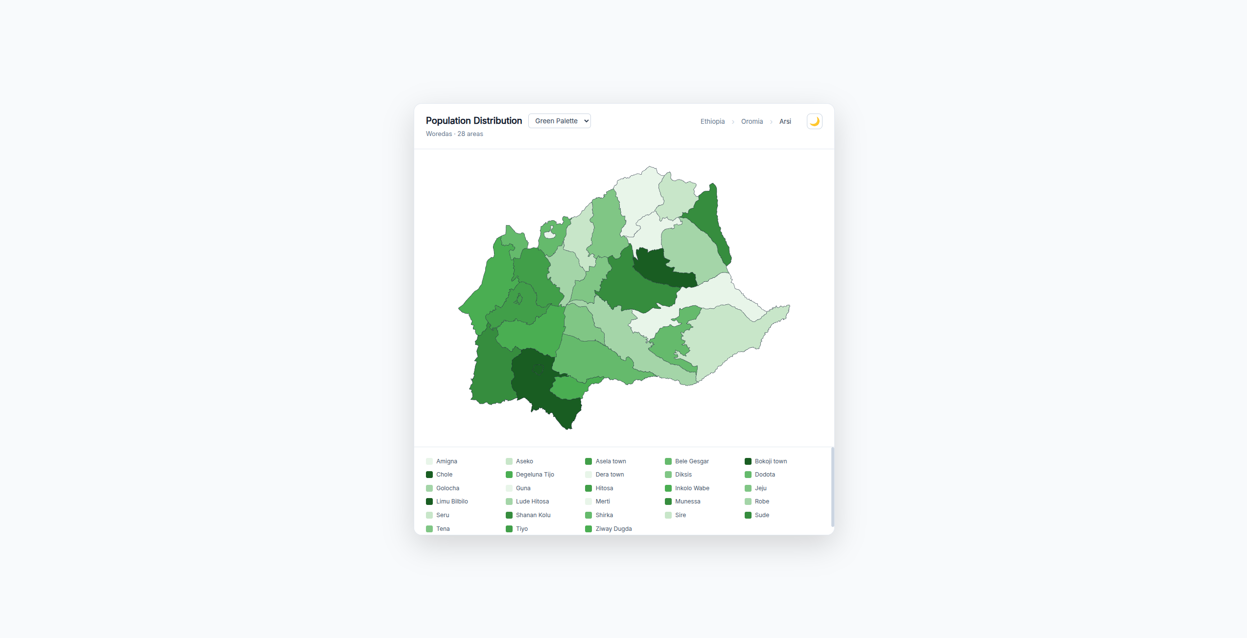
🏠 Woreda Level
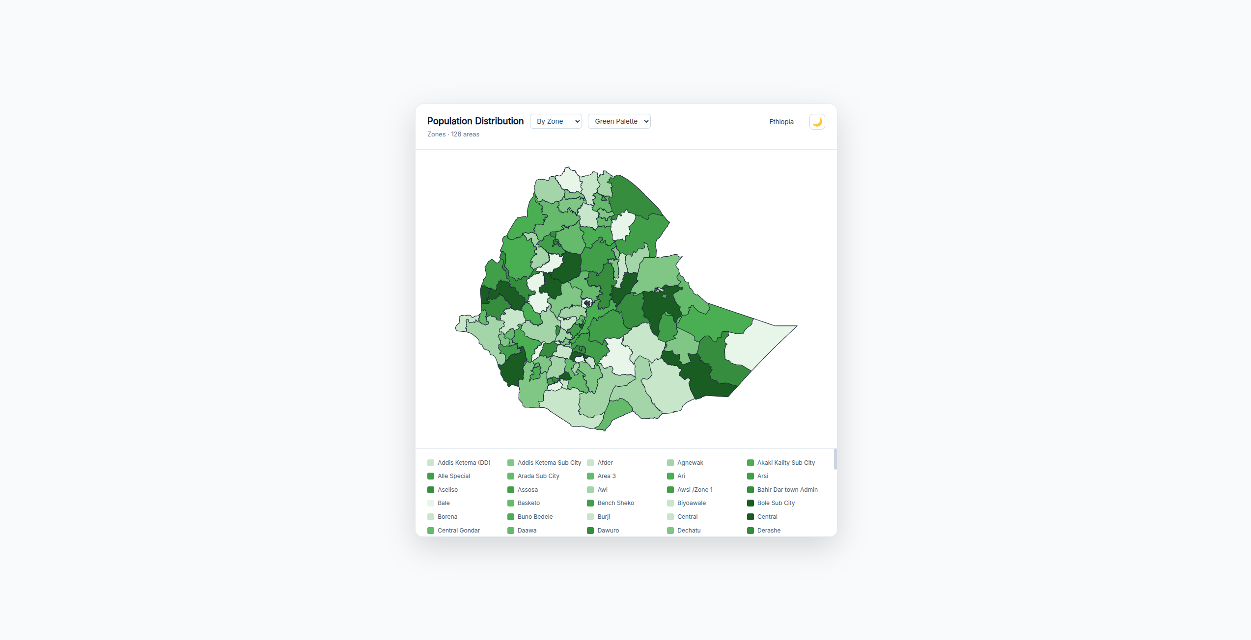
🏠 Zone Level As a whole
Install
npm install ethiopia-geo-boundaries d3Live Demo & Example App
Live Demo: map-et.vercel.app
Example App Repo: HabtamuTesafaye/map_et
What's included
| File | Contents |
|------|----------|
| data/eth-adm0.json | Country outline GeoJSON |
| data/eth-adm1.json | 14 regions GeoJSON (Natural Earth, public domain) with Contested area correctly mapped |
| data/hierarchy.json | 14 regions + zones with PCodes, names, Amharic, capitals, populations |
| vue/EthiopiaMap.vue | Vue 3 / Nuxt 3 choropleth map component |
| scripts/convert-hdx.js | Convert HDX COD-AB shapefile → zone/woreda GeoJSON |
ADM2/ADM3 geometry: Zone and woreda polygons require the HDX COD-AB shapefile (manual download from humdata.org). Run
node scripts/convert-hdx.jsafter placing the shapefile in./input/.
Usage
Install
npm install ethiopia-geo-boundaries d3SVG Paths (ADM1–ADM3)
Import pre-built SVG path strings keyed by P-code:
import { adm1Paths, adm1PathsNames } from 'ethiopia-geo-boundaries/adm1'
import {
  adm2Paths, adm2PathsParents, adm2PathsNames,
} from 'ethiopia-geo-boundaries/adm2'
import {
  adm3Paths, adm3PathsParents, adm3PathsNames,
} from 'ethiopia-geo-boundaries/adm3'adm1Paths/adm2Paths/adm3Paths—Record<string, string>of P-code → SVGdattributeadm1PathsNames/adm2PathsNames/adm3PathsNames—Record<string, string>of P-code → human-readable nameadm2PathsParents/adm3PathsParents—Record<string, string>of child P-code → parent name
Render SVG string
import { renderEthiopiaMap } from 'ethiopia-geo-boundaries'

const svg = renderEthiopiaMap(adm1Paths, {
  colors: { ET04: '#ff0000', ET03: '#00ff00' },
  size: 700,
  stroke: '#1e293b',
  strokeWidth: 1.2,
})
Then render with v-html (Vue) or innerHTML (vanilla JS).
Map Options (MapOptions)
| Option | Type | Default | Description |
|--------|------|---------|-------------|
| values | Record<string, number> | {} | Numeric data keyed by P-code for choropleth |
| colors | Record<string, string> | {} | Explicit hex colors per P-code (overrides values + palette) |
| palette | 'blue' \| 'green' \| 'orange' \| 'red' \| 'purple' | 'blue' | Color palette for choropleth |
| size | number | 800 | SVG canvas size |
| classPrefix | string | 'eth-geo' | CSS class prefix for path elements |
| stroke | string | '#ffffff' | Stroke color |
| strokeWidth | number | 0.5 | Stroke width |
| showLegend | boolean | false | Render legend inside SVG |
| legendLabels | [string, string] | ['Low', 'High'] | Legend labels |
Matching names to P-codes
Use the names dictionaries to look up P-codes:
import { adm1PathsNames, adm2PathsNames } from 'ethiopia-geo-boundaries/adm1' // or /adm2

// Find P-code for a name
const pcode = Object.keys(adm1PathsNames).find(k => adm1PathsNames[k] === 'Oromia')
Region P-codes
| P-code | English | Amharic | Capital | |--------|---------|---------|---------| | ET01 | Tigray | ትግራይ | Mekelle | | ET02 | Afar | አፋር | Semera | | ET03 | Amhara | አማራ | Bahir Dar | | ET04 | Oromia | ኦሮሚያ | Addis Ababa | | ET05 | Somali | ሶማሌ | Jijiga | | ET06 | Benishangul-Gumuz | ቤኒሻንጉል-ጉምዝ | Asosa | | ET07 | Central Ethiopia | ማዕከላዊ ኢትዮጵያ | Hosaina | | ET08 | South Ethiopia | ደቡብ ኢትዮጵያ | Arba Minch | | ET11 | South West Ethiopia | ደቡብ ምዕራብ | Bonga | | ET12 | Gambela | ጋምቤላ | Gambela | | ET13 | Harari | ሐረሪ | Harar | | ET14 | Addis Ababa | አዲስ አበባ | Addis Ababa | | ET15 | Dire Dawa | ድሬዳዋ | Dire Dawa | | ET16 | Sidama | ሲዳማ | Hawassa |