
geopreview
v1.0.2
Published
Terminal preview for geospatial files (GeoJSON, FlatGeobuf, GeoParquet)
Maintainers
 _shimizu
Readme
geopreview
Geospatial file inspector for the terminal. Displays statistics summary and a Braille-character map preview.
Supported Formats
| Format | Extension |
|---|---|
| GeoJSON | .geojson, .json |
| FlatGeobuf | .fgb |
| GeoParquet | .parquet |
Install
npm install -g geopreviewRequires Node.js v18+.
Usage
geopreview <file>Options
| Option | Description | Default |
|---|---|---|
| --no-map | Hide map preview | — |
| --width, -w | Map width (chars) | terminal width - 4 |
| --height, -h | Map height (chars) | 24 |
| --props, -p | Property display limit | 15 |
Examples
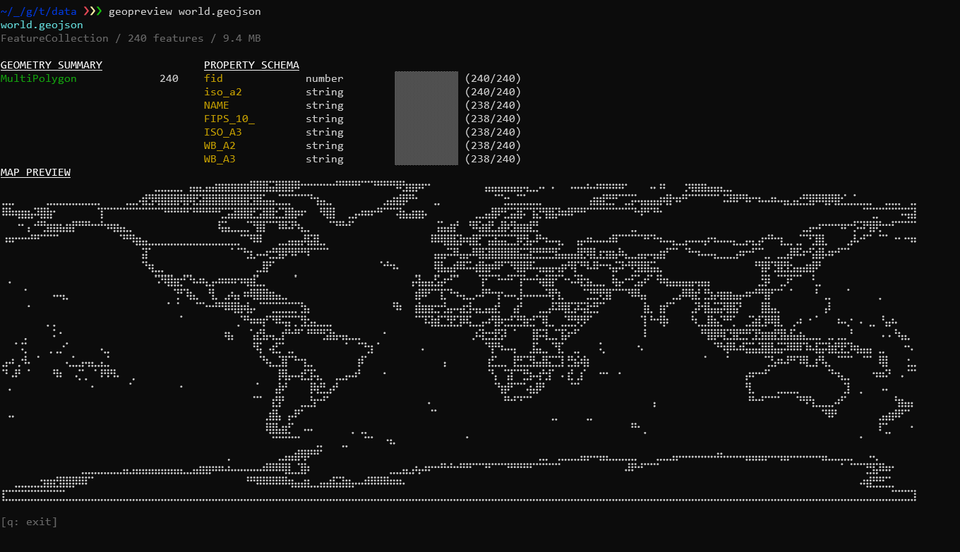
geopreview world.geojson
geopreview countries.fgb --no-map
geopreview buildings.parquet --props 30
geopreview routes.geojson -w 100 -h 30
Keyboard
| Key | Action |
|---|---|
| q / Ctrl+C | Exit |
What It Shows
- Header — File name, feature count, file size
- Geometry Summary — Count per geometry type (Point, Polygon, MultiPolygon, etc.)
- Property Schema — Property names, types, and fill rate with visual bar
- Map Preview — Braille-character rendering of all geometries
License
ISC