
mapcachetools
v2.3.1
Published
A Node.js tool to download and cache map tiles (OSM, Mapbox Satellite, Mapbox Terrain RGB) as PNG images for offline use in mapping applications. Use at your own risk and comply with provider terms.
Maintainers
 mhefny
Readme
Map Cache Tools
A robust Node.js tool to download map tiles (satellite or terrain RGB) for a specified geographic area and zoom range, storing them as PNG images in a folder. Ideal for offline map applications, such as integration with Leaflet or 3D rendering projects like WebGL-based terrain visualization. Features include parallel downloads, retry handling, progress tracking, and support for multiple map providers.
Watch a demo video showcasing the tool:
Features
- Supported Providers: OpenStreetMap (OSM), Mapbox Satellite, Mapbox Terrain RGB (for elevation data), and Stadiamaps Satellite.
- Unified PNG Format: All tiles are saved as PNG, with Mapbox Satellite and Stadiamaps tiles converted from JPG for consistency.
- Parallel Downloads: Configurable concurrency to optimize speed while respecting provider rate limits.
- Retry Mechanism: Automatically retries failed downloads (default: 3 attempts) with exponential backoff.
- Progress Tracking: Displays real-time progress with percentage completion.
- File Management: Skips existing files unless
--forceis used, with automatic output folder creation. - Flexible Zoom: Download tiles for a range of zoom levels (min
--zoutto max--zin). - Integration: Outputs tiles compatible with 3D mapping projects (e.g., Three.js terrain rendering) and Leaflet-based map servers.
Installation
Option 1: Run Directly via npx (No Install)
Run the tool without a global install:
npx mapcachetools --helpThen run the tool with:
npx mapcachetools --lat1=<lat> --lng1=<lng> --lat2=<lat> --lng2=<lng> --zin=<max_zoom> --folder=<output_folder> [options]Option 2: Install Globally via npm
Install the package globally to use the mapcache-download command from anywhere:
npm install -g mapcachetoolsThen run the tool with:
mapcache-download --lat1=<lat> --lng1=<lng> --lat2=<lat> --lng2=<lng> --zin=<max_zoom> --folder=<output_folder> [options]Option 3: Clone and Run Locally
Clone the repository:
git clone https://github.com/HefnySco/mapcache.git
cd mapcache
Run using
npxfrom this local folder:npx --package . mapcachetools --helpOr run using Node directly:
node ./bin/mapcache_download.js --helpNote: The
sharplibrary is required for JPG-to-PNG conversion. Ensure system dependencies are installed:- Ubuntu/Debian:
sudo apt-get install libvips-dev - macOS:
brew install libvips
- Ubuntu/Debian:
Usage
Download map tiles for a geographic area defined by two coordinates (lat1,lng1 to lat2,lng2), a zoom range, and an output folder. Run the script with:
npx mapcachetools --lat1=<lat> --lng1=<lng> --lat2=<lat> --lng2=<lng> --zin=<max_zoom> --folder=<output_folder> [options]If you cloned the repo and want to run from the local folder, use:
npx --package . mapcachetools --lat1=<lat> --lng1=<lng> --lat2=<lat> --lng2=<lng> --zin=<max_zoom> --folder=<output_folder> [options]If you installed globally, use:
mapcache-download --lat1=<lat> --lng1=<lng> --lat2=<lat> --lng2=<lng> --zin=<max_zoom> --folder=<output_folder> [options]Example: Download OSM Tiles
Download OpenStreetMap tiles for a small area with zoom levels 0 to 14:
npx mapcachetools --lat1=40.7128 --lng1=-74.0060 --lat2=40.7228 --lng2=-73.9960 --zin=14 --zout=0 --folder=./site/cachedMapsExample: Download Mapbox Satellite Tiles
Download Mapbox satellite tiles (saved as PNG, requires a Mapbox access token):
npx mapcachetools --lat1=40.7128 --lng1=-74.0060 --lat2=40.7228 --lng2=-73.9960 --zin=14 --folder=./site/cachedMaps --provider=1 --token=pk.eyJ1IjoibWhlZm55IiwiYSI6ImNrZW84Nm9rYTA2ZWgycm9mdmNscmFxYzcifQ.c-zxDjXCthXmRsErPzKhbQExample: Download Mapbox Terrain RGB Tiles
Download Mapbox terrain RGB tiles for elevation data:
npx mapcachetools --lat1=40.7128 --lng1=-74.0060 --lat2=40.7228 --lng2=-73.9960 --zin=14 --folder=./site/cachedMaps --provider=2 --token=pk.eyJ1IjoibWhlZm55IiwiYSI6ImNrZW84Nm9rYTA2ZWgycm9mdmNscmFxYzcifQ.c-zxDjXCthXmRsErPzKhbQExample: Download Stadiamaps Satellite Tiles
Download Stadiamaps satellite tiles (saved as PNG, requires a Stadiamaps API key):
npx mapcachetools --lat1=40.7128 --lng1=-74.0060 --lat2=40.7228 --lng2=-73.9960 --zin=14 --folder=./site/cachedMaps --provider=3 --token=<your-stadiamaps-api-key>Options
--lat1, --lng1: Starting coordinates (required).--lat2, --lng2: Ending coordinates (required).--zin: Maximum zoom level (required, e.g., 18).--zout: Minimum zoom level (default: 0).--folder: Output folder for tiles (required, e.g.,./site/cachedMaps).--provider: Map provider (0=OSM, 1=Mapbox Satellite, 2=Mapbox Terrain RGB, 3=Stadiamaps Satellite; default: 0).--token: Mapbox or Stadiamaps access token (required for provider 1, 2, or 3).--concurrency: Number of parallel downloads (default: 5).--retries: Retry attempts for failed downloads (default: 3).--force: Redownload existing files (default: false).--help, -h: Display help message.--version, -v: Display script version.
Serving Tiles Locally
Use a local HTTP server to serve downloaded tiles for testing with Leaflet or other map libraries:
cd site
npm install -g http-server
http-server
Access the tiles at http://localhost:8080/cachedMaps. The folder ./site/cachedMaps contains tiles named as:
- OSM:
osm_<x>_<y>_<zoom>.png - Mapbox Satellite:
sat_<x>_<y>_<zoom>.png - Mapbox Terrain RGB:
terrain_<x>_<y>_<zoom>.png - Stadiamaps Satellite:
stadiamaps_<x>_<y>_<zoom>.png
Integration with 3D Mapping Projects
The downloaded tiles are saved as PNG, compatible with 3D mapping applications like Three.js for terrain rendering. For example, Mapbox terrain RGB tiles can be used to generate heightmaps:
const terrainData = await textureLoader.loadAsync('terrain_<x>_<y>_<zoom>.png');
const data = getPixelData(terrainData); // Extract RGB values
const height = -10000 + ((r * 65536 + g * 256 + b) * 0.1); // Mapbox terrain RGB formula
Ensure the output folder matches your project's tile cache directory, and use the same zoom levels (e.g., 14) for consistency with your rendering logic.
Map Providers
- OpenStreetMap (OSM): Free, no token required. Tiles are natively PNG. Website.
- Mapbox Satellite: High-quality satellite imagery, converted from JPG to PNG for consistency. Requires a Mapbox access token. Website.
- Mapbox Terrain RGB: Elevation data encoded in RGB PNG tiles. Requires a Mapbox access token. Website.
- Stadiamaps Satellite: High-quality satellite imagery, converted from JPG to PNG. Requires a Stadiamaps API key. Website.
Obtain a Mapbox token from Mapbox Account or a Stadiamaps API key from Stadiamaps Account.
Notes
- Rate Limits: Mapbox and Stadiamaps enforce rate limits. Adjust
--concurrencyto avoid being throttled. - File Overwrites: Use
--force=trueto redownload tiles if they are outdated or corrupted. - File Size: Mapbox Satellite and Stadiamaps tiles are converted to PNG, which may increase file size compared to JPG. Consider disk space for large areas.
- Tile Validation: For critical applications, validate PNG tiles post-download to ensure integrity (e.g., using
sharpmetadata).
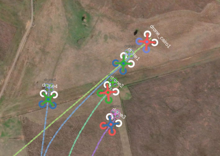
USE CASE
DroneEngage Airgap Server uses MapCache to cache map tiles for offline use in drone missions.
Disclaimer
Please review the terms and conditions of your chosen map provider (e.g., OpenStreetMap, Mapbox, Stadiamaps). The author assumes no liability for any incidental, consequential, or other damages arising from the use of this tool.
Package Sidebar
Install
npm i mapcachetools
Version
2.2.6
License
ISC
Unpacked Size
22.7 kB
Total Files
6