
node-red-node-geofence
v0.3.4
Published
A simple node to filter based on location
Downloads
633


Readme
node-red-node-geofence
Geofence node for Node-RED
This uses the geolib node to check if points fall with in a given region. Points are taken from the first of the following msg properties in this order:
- msg.location.lat & msg.location.lon
- msg.lat & msg.lon
- msg.payload.lat & msg.payload.lon
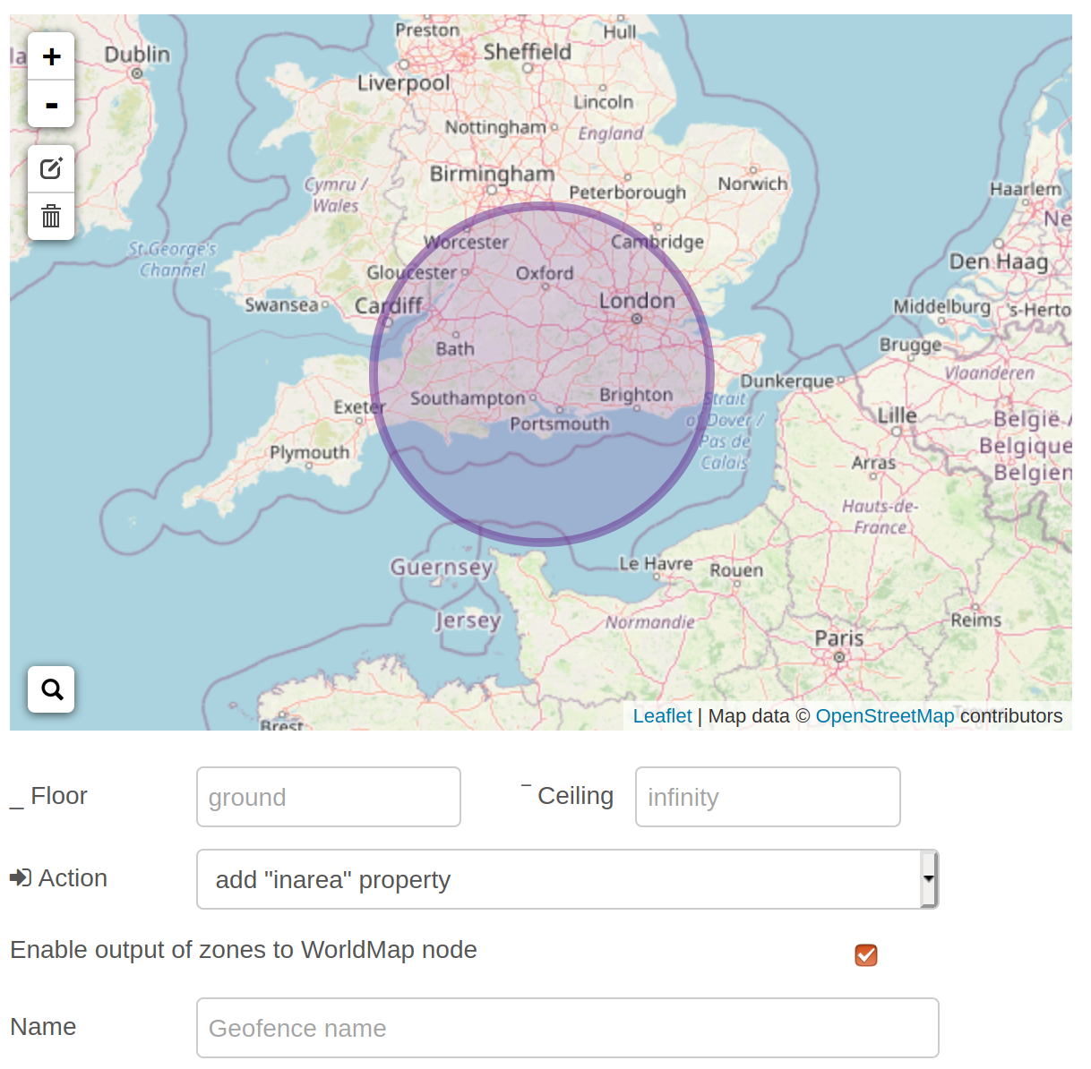
Region can be circular, rectangular or polygons and are drawn on to a map in the config node.
Messages can be filtered depending on if they fall inside or outside the given region or the node can append the node name to a list of areas the msg falls in (to allow the chaining of geofence nodes).
The list is stored in msg.location.isat in the following format:
msg.location: {
    inarea: true,
    isat: [
      'firstArea',
      'secondArea'
    ],
    distances: {
      'firstArea': 100,
      'secondArea': 15
    }
}
And also includes the distance in meters from the centre (or centroid for polygons) of the region.
The config node uses leaflet and openstreetmap data so requires internet access. You can drop back to a non graphical config by replacing geofence.html with geofence-nomap.html
Possible breaking changes moving from version 0.0.x to 0.1.0.
These are arround the "add 'inarea'" mode
- msg.location.inarea is always a boolean and now just reflects the last geofence node that the message passes through
- msg.location.distances is now just an object using the name as a key, rather than an array of objects
WorldMap Support
If the check box is ticked then a second output port will be added to the node. The msg
output from this port will include the shape of the geofence zone that can be fed directly
into a WorldMap node so that it will be drawn on the geofence layer.
This output is triggered by a message with msg.payload.action set to send. This can be
initiated by using the WorldMap in node when a new browser connects.