
signalk-routeiq
v0.1.0-alpha.7
Published
SignalK Nautical Route Planner - Offline tide and vessel-aware routing
Downloads
1,249

Maintainers
 marcelrv
Readme

SignalK RouteIQ Nautical Route Planner
⚠️ Alpha release. RouteIQ is under active development. Routing data currently only covers a small set of test regions (parts of the Netherlands and the US East Coast) — it is not yet suitable for real-world passage planning. Use it for testing and feedback only, always verify routes against official charts, and do not rely on it for actual navigation.
An offline-first, vessel-aware nautical route planner designed to run natively as a webapp and plugin within the Signal K ecosystem. Optimized for inland waterways and coastal navigation, it dynamically calculates safe routes based on a vessel's physical dimensions (draft, beam, air draft) and user safety preferences.


Features
- Offline-First Routing: Pre-computed routing graph enables instant route calculation without internet connectivity
- Vessel-Aware: Considers draft, beam, and air draft (with configurable safety margins) to ensure safe navigation
- Tide-Aware (optional): Can factor in tidal currents — needs a tide data plugin installed and running:
signalk-tidal-currentsfor real harmonic current stations (preferred), and/orsignalk-tidesfor a height-derived estimate. Without either, routes fall back to plain distance - Interactive Web UI: Leaflet-based map interface with click-and-drag route planning
- Freeboard-SK Integration: Runs as a Freeboard-SK Plotter Extension panel, so you can plan routes without leaving Freeboard-SK's own charting UI
- GPX Export: Export routes for use in OpenCPN, WilhelmSK, and other navigation software
- POI Search: Offline search for ports, marinas, locks, and other points of interest
- Chart Selection: Nautical charts via Signal K's
resources/chartsAPI (raster and S-57 vector), plus built-in OpenStreetMap / OpenSeaMap - Downloadable Routing Data: Fetch pre-compiled regional routing databases on demand from within the app — no manual data prep required
Screenshots
| | |
|---|---|
| 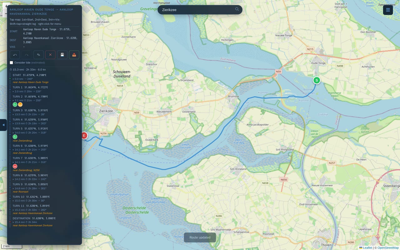 Planning a route through the Zeeland delta |
 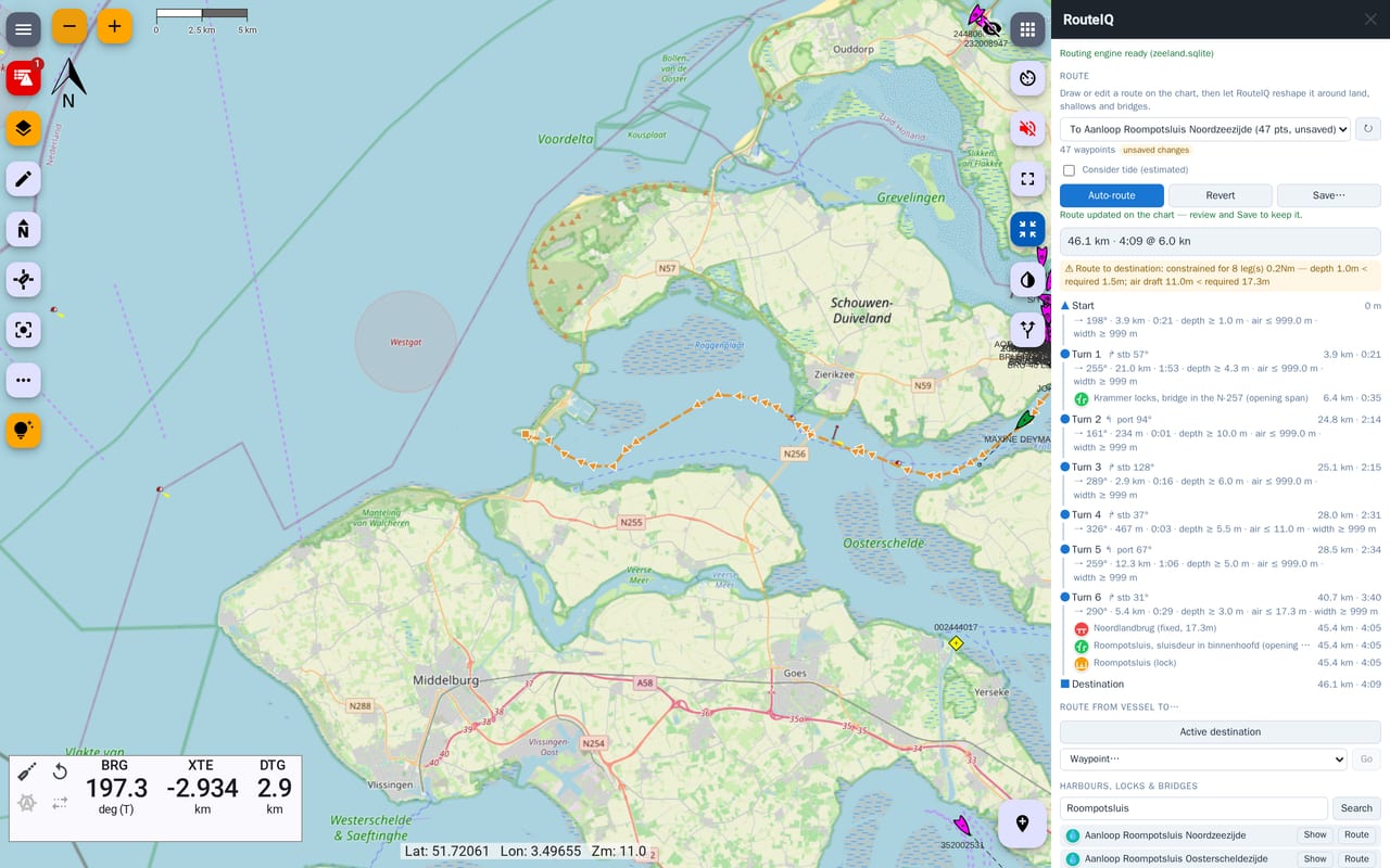 Running as a Freeboard-SK plotter extension |
|
Running as a Freeboard-SK plotter extension |
| 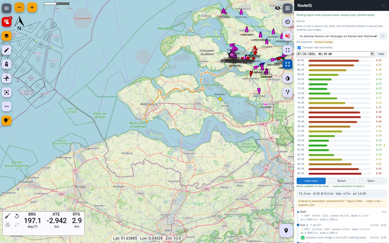 Tide-aware routing with a 24 h departure scan |
 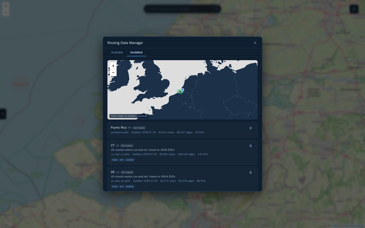 Downloading and managing regional routing data |
|
Downloading and managing regional routing data |
| 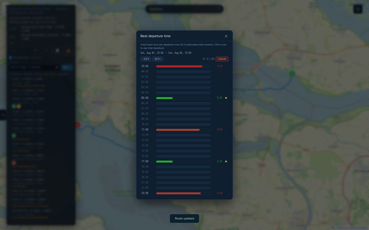 The departure planner mid-scan — every hour of the window is listed at once and fills in coarse to fine, so the best departure shows up long before the scan ends | |
How It Works
RouteIQ is made up of three pieces:
- A cloud data pipeline (separate repo, signalk-router-pipeline) that processes nautical charts into compiled routing databases.
- This Signal K plugin, which runs on your Signal K server, loads one or more of those databases, and calculates routes.
- A web app, served by the plugin, for planning routes on a chart and exporting them.
Compiled routing databases are published to signalk-router-data and can be downloaded directly from the plugin's "Manage Routing Data" screen — you don't need to run the pipeline yourself.
RouteIQ can be used two ways: as its own standalone web app (served by the plugin), or embedded directly inside Freeboard-SK as a Plotter Extension panel, so you can plan routes on top of the chart you're already viewing there.
Installation
- Install RouteIQ from the Signal K App Store (Server → Appstore, in your Signal K server's admin UI), or manually by placing this plugin in your Signal K server's
node_modules. - Restart your Signal K server and enable the plugin under Server → Plugin Config.
- Open the RouteIQ web app (linked from the Signal K webapps list), or open it as a panel inside Freeboard-SK if you use that.
- Click the ☰ menu icon in the top-right corner of the screen to open the Routing / Charts / View settings, and use Manage Routing Data there to download a routing database for your area.
- Set your vessel dimensions (or let RouteIQ auto-detect them from
design.draftetc. if your Signal K server provides them) and start planning routes.
Want tide-aware routing? Install and enable a tide data plugin first — signalk-tidal-currents for real harmonic current stations, and/or signalk-tides for a height-derived estimate — then turn on "Consider Tides" in RouteIQ's settings (☰ menu → Routing) or per request. When both are available RouteIQ prefers the current stations and falls back to the height estimate outside their range.
Configuration
These settings are available under Server → Plugin Config → RouteIQ:
| Setting | Default | Description |
|---|---|---|
| Routing Data Directory | the plugin's data directory | Directory containing the .sqlite routing graph files RouteIQ loads. Empty means <Signal K config>/plugin-config-data/signalk-routeiq/routing-data, which survives plugin updates; a relative path is resolved against the plugin install directory |
| Draft Safety Margin (m) | 0.3 | Under-keel clearance added to the vessel's design draft |
| Air Draft Safety Margin (m) | 1.5 | Mast clearance added to the vessel's design air draft |
| Beam Safety Margin (m) | 2.0 | Width clearance added to the vessel's design beam |
| Default Min Coast Distance (NM) | 0.5 | Default minimum distance to keep from the coastline |
| Average Speed (kn) | 6.0 | Cruising speed used to estimate route duration / ETA |
| Typical Lock Wait (min) | 60 | Time allowed for each lock on the route, counted towards duration and ETA. Adjustable per route under ☰ → Routing |
| Typical Opening Bridge Wait (min) | 30 | Time allowed for each opening bridge. Fixed spans cost nothing |
| Consider Tides by Default | off | Factor in tidal currents when calculating routes (needs signalk-tidal-currents and/or signalk-tides); can be overridden per request |
| Max Tidal Current (kn) | 2.0 | Spring-tide current at full flood/ebb, used to scale the estimated tidal flow model |
| Tides API Base URL | this server | Server hosting the tide/current data plugins, if not this one |
| Waypoint Simplification Tolerance (m) | 30 | Max deviation allowed when simplifying the computed path down to route waypoints |
| Wrong Way Penalty | 5.0 | Cost penalty applied when routing against marked traffic flow |
| Line-of-Sight Sample Interval (m) | 500 | Spacing between samples when checking line-of-sight for route smoothing |
| Line-of-Sight Search Radius (m) | 0 | Radius to search for graph nodes when verifying line-of-sight |
| Database Catalog URL | signalk-router-data catalog | Where to look for downloadable routing databases |
| Dynamic Database Loading | on | Load each region into memory only when a route actually needs it, instead of loading everything at startup. Recommended when you have multiple regional databases installed |
| Eager-load Region at Vessel Position | on | With dynamic loading on, pre-load the region under the vessel so it's ready to route as soon as it's positioned |
| Proactive Load Radius (NM) | 0 | Load a region before the vessel actually enters it, once within this distance |
| Max Loaded Regions | 6 | Cap on how many regions stay loaded in memory at once when using dynamic loading |
Safety Constraints & Routing
Routes avoid edges where:
- Water depth is insufficient for the vessel's draft (plus safety margin)
- Vertical clearance is insufficient for the vessel's air draft (plus safety margin)
- Channel width is insufficient for the vessel's beam (plus safety margin)
- Distance to land is below the configured minimum coast distance
Routing prefers marked fairways over open water and penalizes travel against marked traffic flow.
License
Apache License 2.0 - see LICENSE file for details
Contributing
This is an alpha-stage project. Bug reports and feedback are very welcome — please open an issue or pull request on GitHub.
Acknowledgments
- Signal K team for the plugin framework
- Dutch Hydrographic Office and Rijkswaterstaat for reference data
- OpenStreetMap and OpenSeaMap contributors for map tiles
- Freeboard-SK (Apache-2.0) — the webapp's chart-source handling (Signal K
resources/chartsnormalisation, built-in OSM/OpenSeaMap sources) and its simplified S-52 chart styling are adapted from Freeboard-SK, which in turn derives its S-52 symbology rules from OpenCPN's s52plib