
strapi-plugin-geometry-fields
v1.0.8
Published
Store and edit geospatial data with PostGIS in a Strapi custom field


Readme
Geometry Fields plugin for Strapi
Store and edit geospatial data with PostGIS in a Strapi v4 custom field.
NOTE: For this plugin supported by Strapi v5, see @gismark/strapi-geometry-fields.
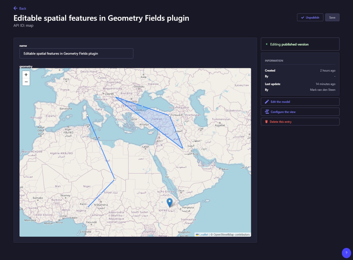
The plugin accepts WKT (Well-known text) from the API and stores it in a PostGIS column in the db table of the content type. You can use multiple geometry fields across different content types. All features are editable and draggable using the hosted Leaflet.Editable and Path.Drag.
Below is an example following this WKT input: "GEOMETRYCOLLECTION (POINT (40 10), LINESTRING (10 10, 20 20, 10 40), POLYGON ((40 40, 20 45, 45 30, 40 40)))"
Installation
Configuration
This plugin only runs with PostgreSQL and needs PostGIS to be installed. If you haven't already done so run this query in Postgres:
For the Leaflet map and the markers to display you must allow Openstreetmap in your middlewares.js. Update "strapi::security" like so:
Usage
In the Content Type Builder
- Create a new collection type
- In the field selection, choose CUSTOM, select the Geometry field and give it a name
- Finish & Save
In the code
Add this field to the schema.json of your content type ('geometry' can be any unique field name)
## Examplesinput as WKT
Tested with
- Strapi 4.25.22
- PostgreSQL 12.4
- PostGIS 3.0.2
License
MIT
Todo
- Add GeoJSON support
- Validate WKT / GeoJSON option
- Choose CRS (Coordinate Reference System) from settings
- Create & delete features in custom field
- Click feature shows popup with geo info