
svgmap-gujarat
v0.0.2
Published
Interactive map of Gujarat for React
Maintainers
 arav-ind
Readme
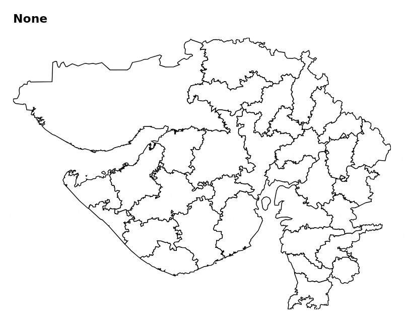
Interactive Map of Gujarat
This package generates an interactive SVG map of Gujarat. It allows users to highlight districts on hover and retrieve the value of the selected district.
Installation
Install the package via npm:
pnpm install svgmap-gujaratDistrict List
The following are the districts mapped with its ID.
export const districtNames: {[code: string]: string}
Usage
'use client'

import React, { useState } from 'react'
import GujaratMap, { districtNames } from 'svgmap-gujarat'

const App = () => {
    const [selectedValue, setSelectedValue] = useState<string | null>(null)

    return (
        <div>
            <h3>{selectedValue ? `${selectedValue}: ${districtNames[selectedValue]}` : 'None'}</h3>
            <GujaratMap
                onClick={(value: string) => setSelectedValue(value)}
                size="400px"
                mapColor="white"
                strokeColor="black"
                strokeWidth="2"
                hoverColor="rgb(80 80 80)"
            />
        </div>
    )
}

export default App
Props Available
| Props | Description | Requirement | Default Value | | ----------- | -------------------------------------------------- | ----------- | ------------- | | onClick | Callback function to get the selected state value. | Required | NA | | className | Custom classname for the map component. | Optional | "svgmap" | | size | Width of the map. | Optional | "inherit" | | mapColor | Color of the map. | Optional | "#ffffff" | | strokeColor | Border color of each state. | Optional | "#000000" | | strokeWidth | Border width of each state. | Optional | "0.5" | | hoverColor | Color of the state while hovering on it. | Optional | "#303030" |
Contributing
Pull requests are welcome.