xgis-bdgrid
v0.1.3
Published
基于GB/T 39409-2020b标准实现北斗网格位置码的编码、解码和剖分计算的基础库。
Downloads
108
Maintainers
 zorrowm
Readme
xgis-bdgrid
xgis-bdgrid基础库
北斗网格位置码编码与计算的基础库
基于beidou-grid-location-codec库的进行定制修改与扩展,实现北斗网格位置码(GB/T 39409-2020)标准,用于2D/3D北斗网格编码、解码和剖分计算。(目前基于网格的空间计算功能正在内部测试完善中……)
- v0.1.3 优化完善部分方法,增加bdgrid_elevation_n(或getN2)根据网格编码结构体获取层数;getGridBoxByCode3D合并getGridBoxByStruct(去掉);getVertexOptionsByCode3D合并getVertexOptionsByStruct(去掉);
- v0.1.2 增加获取网格8个订点坐标方法:getVertexOptionsByStruct、getVertexOptionsByCode3D和getVertexOptionsByMeshMeta;
- v0.1.1 修改完善spatial_3d_contains方法;
- v0.1.0 修改高度边界计算层级问题(例如:1层的顶是2层的底,应属于2层);
- v0.0.9 修改层级计算错误(应该向上取整),修改其他小问题;
- ~~v0.0.8 修改发现的内部bug;增加相邻关系判断;~~
- ~~v0.0.7 新增部分方法;增加内部基础常量导出;~~
- ~~v0.0.6 重构代码分组和方法命名,空间编码(bdgrid_2d_和 bdgrid_3d_) 、空间运算(spatial_2d_和 spatial_3d_)、高度编码(bdgrid_elevation_);~~
- ~~v0.0.5 解决内部bug;增加临近网格计算;~~
- ~~v0.0.4 解决0.0.3版本存在的问题。~~
- ~~v0.0.3 增加基于北斗编码的空间运算引擎。~~
- ~~v0.0.2 修改功能BUG,补充新功能。~~
- ~~v0.0.1 初始版本,包括网格编码、解码和剖分计算。~~
主要功能:
二维网格(含极坐标)编码、解码、参考短码、短码还原、最大级别、临近网格等
三维网格编码、解码,高程编码、解码,临近网格
三维网格剖分
使用
pnpm add xgis-bdgrid
or
npm i xgis-bdgrid
import type { IGrid3DMeta } from "xgis-bdgrid";
import { Cesium, GroundPrimitiveLayer } from 'xgis-cesium';
import {
computeGrid3DMeshMeta,
createGridBoxOptions,
getAboveFitLevel,
getArcLengthByLevel,
getGrid2DExtent,
getBoxCenter,
getElevationByLevel,
getGrid3DMeshMeta,
getGridBox,
getGridBoxByMeta,
getGridBoxList,
getGridGeoExtent,
getHeightUnitByLevel,
getLevelAngleRad,
getN,
getNMax,
getRadiusByLevel,
intGrid3DMeshMeta,
searchGrid3DMeta,
getLevelByXRange,
}
from 'xgis-bdgrid';

//初始化代码
    intGrid3DMeshMeta();
    console.log('0000000000加载了widget:  TestBD3DGridWidget');
    const viewer = Global.CesiumViewer;
    if (viewer) {
        const gridPrimitiveLayer = new GroundPrimitiveLayer('testGrid');
        viewer.addLayer(gridPrimitiveLayer);
        console.log('添加了图层,开始构建网格要素')
        testInit2(gridPrimitiveLayer.delegate);
    }
async function testInit2(primitiveCollection: Cesium.PrimitiveCollection) {
const colorGroup = ['#f00', '#ff0', '#0f0', '#00f'];
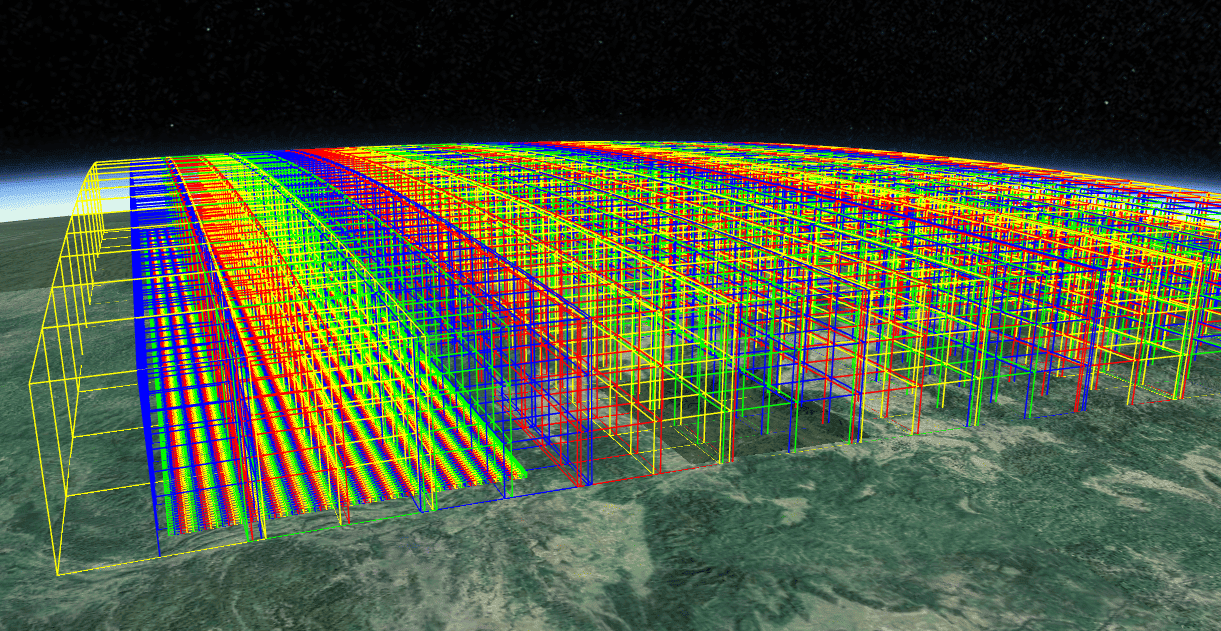
for (let level = 1; level <=3; level++) {
const colorString = colorGroup[level - 1];
const gridBoxOptions= createGridBoxOptions(geoExtent,level);
console.log(level,gridBoxOptions);
const len=gridBoxOptions.length;
for(let i=0;i<len;i++)
{
const gridBoxOption=gridBoxOptions[i];
if(gridBoxOption)
drawGridBoxOutline(gridBoxOption, primitiveCollection, colorString);
}
console.log('完成网格构建,层级:' + level);
}
}function drawGridBoxOutline(gridParam: any, primitiveCollection: Cesium.PrimitiveCollection, colorString: string = '#0f0') {
const center = gridParam.center;
const dimens = gridParam.dimensions;
const position = Cesium.Cartesian3.fromDegrees(center[0], center[1], center[2]);
const dimensions = new Cesium.Cartesian3(dimens[0], dimens[1],dimens[2]);
// BoxOutlineGeometry:创建仅轮廓的长方体
const boxOutlineGeometry = Cesium.BoxOutlineGeometry.fromDimensions({
dimensions: dimensions,
});
const boxOutlineInstance = new Cesium.GeometryInstance({
geometry: boxOutlineGeometry,
modelMatrix: Cesium.Transforms.eastNorthUpToFixedFrame(position),
attributes: {
color: Cesium.ColorGeometryInstanceAttribute.fromColor(Cesium.Color.fromCssColorString(colorString))
}
});
const appearance = new Cesium.PerInstanceColorAppearance({
flat: true,
translucent: false
});
// 轮廓长方体用 LineAppearance(仅渲染线)
const boxOutlinePrimitive = new Cesium.Primitive({
geometryInstances: boxOutlineInstance,
appearance,
});
primitiveCollection.add(boxOutlinePrimitive);
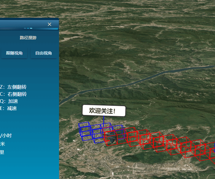
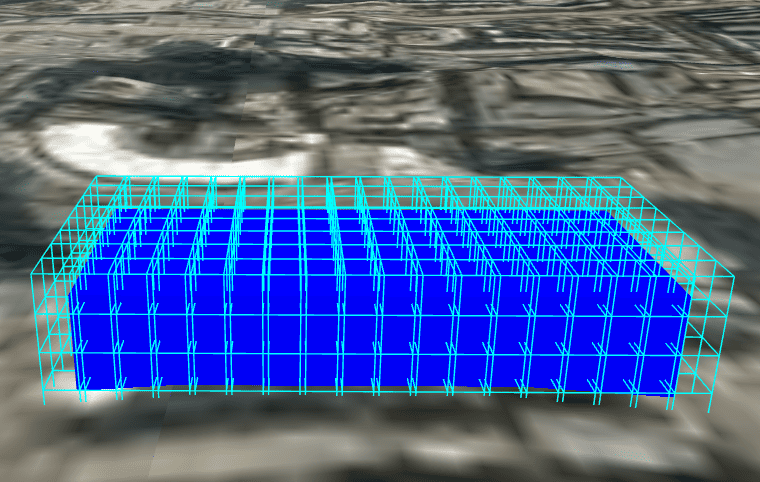
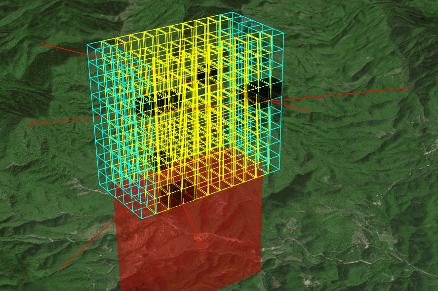
}相邻网格自动扩展,测试代码
import {
bdgrid_2d_between,
bdgrid_2d_codelevel,
bdgrid_2d_decode,
bdgrid_2d_derefer,
bdgrid_2d_encode,
bdgrid_2d_join,
bdgrid_2d_neighbors,
bdgrid_2d_refer,
bdgrid_2d_refer_range,
bdgrid_2d_shorten,
bdgrid_2d_size,
bdgrid_2d_split,
bdgrid_3d_code2d,
bdgrid_3d_codelevel,
bdgrid_3d_contains,
bdgrid_3d_decode,
bdgrid_elevation_decode,
bdgrid_elevation_encode,
bdgrid_3d_elevationcode,
bdgrid_elevation_code,
bdgrid_3d_encode,
bdgrid_3d_join,
bdgrid_3d_neighbor,
bdgrid_3d_neighborcode,
bdgrid_3d_neighborcode2,
bdgrid_3d_parentcode,
bdgrid_3d_split,
Codec3D,
getGrid2DRowCol,
getGrid3DMeshMeta,
getGridBox,
getGridBoxByCode3D,
getGridBoxByStruct,
getN} from 'xgis-bdgrid';
async function testBDGridEngine2(primitiveCollection: Cesium.PrimitiveCollection)
{
const code3D = bdgrid_3d_encode({
lngDegree: 114,
latDegree: 25,
elevation: 2000,
}, 5);
const code3DStruct=bdgrid_3d_split(code3D);
// drawGridByCode(code3D,primitiveCollection);
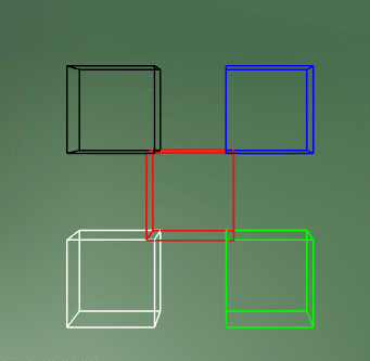
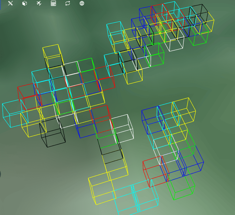
// const code3DStructE= bdgrid_3d_neighborcode(code3D,'NW');
// drawGridByCode(code3DStructE,primitiveCollection,'#00f');
// console.log('444444444',code3DStruct,code3DStructE);
//,'SW','NW' 'NE','SE','SW','NW', 'U',
const group=['E','W','N','S','NE','SE','SW','NW'];//['E','SE','SW'];//,'U','D' ,'U','D'
const colorStrs=['#00f','#0f0','#FFF','#000','#ff0','#ff0','#0ff','#0ff','#f00','#ff'];
let current=code3DStruct;
for(let i=0;i<100;i++)
{
const dir=getRandomItem(group);//'E';
const code3DStructE= bdgrid_3d_neighborcode2(current,dir);
drawGridByCode(code3DStructE,primitiveCollection,colorStrs[i%9]);
current=code3DStructE;
console.log('000000000完成第:'+i,dir);
}
}
async function drawGridByCode(code3d:string|IBDCodeStruct,primitiveCollection: Cesium.PrimitiveCollection,colorStr='#f00')
{
let gridBoxOption:any;
if(isString(code3d))
gridBoxOption=await getGridBoxByCode3D(code3d);
else
gridBoxOption= await getGridBoxByStruct(code3d);
if (gridBoxOption)
{
//console.log('7777777777888',colorStr,gridBoxOption);
drawGridBoxOutline(gridBoxOption, primitiveCollection, colorStr);
}
}//根据高度和级别,计算层级
const n1= getN(5,551);
//根据三维码,计算高度值和层级
const codeEle0 = bdgrid_elevation_code(code3DStruct);
const height0 =bdgrid_elevation_decode(codeEle0);
const n0 = getN(5, height0);同步参考:https://www.npmjs.com/package/beidou-grid-location-codec
应用示例