
xgis-cesium-mars3d
v0.0.4
Published
基于mars3d-cesium开发的,结合项目经验积累,进行定制的内部使用版!


Readme
xgis-cesium-mars3d
xgis-cesium-mars3d是基于mars3d-cesium扩展开发的,结合项目经验积累,进行定制的内部使用版。 非商业项目免费使用,商业应用请购买使用授权key。
基于mars3d-cesium的三维开发框架
v0.0.4 升级基础库;解决注记等webworker方法不能使用问题;
- v0.0.3 升级基础库,基于mars3d-cesium发布版1.134.0,对应mars3d v3.10.6版;
- v0.0.2 升级对应到xgis-cesium 0.4.0版本(除地形压平暂不能用),基于mars3d-cesium发布版1.125.0;
- v0.0.1 (内测版)对接基于mars3d-cesium发布版1.125.0(只外部依赖,不导出Cesium全局对象),对应xgis-cesium 0.2.8版本.
使用说明
直接安装使用mars3d 和mars3d-cesium最新版 手动拷贝资源:**node_modules/xgis-cesium-mars3d/dist/assets/worker-*.js ** 到 项目的 **public/assets/ **目录下
对接mars3d使用示例代码工程:(参考验证)
https://github.com/zorrowm/xgis-cesium-mars3d-example
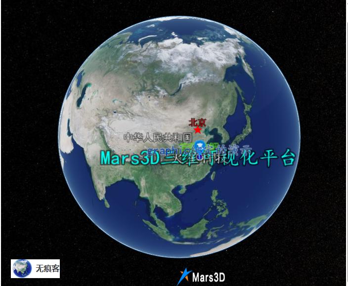
核心功能
核心的XViewer是扩展Cesium.CesiumWidget的实现,增加很多基础功能
基础图层管理,支持多种地图底图
图层树管理功能
三维标绘功能
空间分析功能
天气(积雪效果)
三维矢量注记
安装
npm i xgis-cesium-mars3d mars3d-cesium mars3d
需要引入类库样式:
import 'xgis-cesium-mars3d/dist/index.css'
使用方法
1、安装mars3d-cesium库
2、使用XViewer初始化构建球
    import {XViewer} from 'xgis-cesium-mars3d';
    import * as Cesium from 'mars3d-cesium';

//初始化地球
function initCesiumViewer() {
  try {
    Cesium.Camera.DEFAULT_VIEW_FACTOR = 0.4;
    Cesium.Camera.DEFAULT_VIEW_RECTANGLE = Cesium.Rectangle.fromDegrees(102, 5, 115, 70);
    //https://cesium.com/learn/cesiumjs/ref-doc/Viewer.html#.ConstructorOptions
    const viewer = new XViewer('mars3dContainer', {
      animation: false, //是否创建动画小器件,左下角仪表
      baseLayerPicker: false, //是否显示图层选择器
      fullscreenButton: false, //是否显示全屏按钮
      geocoder: false, //是否显示geocoder小器件,右上角查询按钮
      homeButton: false, //是否显示home按钮
      infoBox: false, //是否显示信息框
      sceneModePicker: false, //是否显示3D/2D选择器
      selectionIndicator: false, //是否显示选取指示器组件 鼠标绿色框
      timeline: false, // 是否显示时间轴
      navigationHelpButton: false, // 是否显示右上角的帮助按钮
      vrButton: false, // 是否显示双屏
      scene3DOnly: true, // 如果设置为true,则所有几何图形以3d模式绘制以节约gpu资源
      contextOptions: {
        // cesium状态下允许canvas转图片convertToImage
        webgl: {
          preserveDrawingBuffer: true, //通过canvas.toDataURL()实现截图需要将该项设置为true
        },
      },
      requestRenderMode: false,//优化性能,需要主动触发更新   scene.requestRender();
      targetFrameRate: 45,

      automaticallyTrackDataSourceClocks: false,
      //是正确的
      baseLayer: false,
      //默认地形-无地形
      // terrainProvider: new Cesium.EllipsoidTerrainProvider(),
      //允许动画
      shouldAnimate: true,
    });
    viewer.clock.currentTime = Cesium.JulianDate.fromDate(new Date());
    return viewer;
  }
  catch (error) {
    // Global.Message.err('Cesium Viewer初始化失败!');
    // Global.Logger().error('Cesium Viewer初始化失败', error);
  }
  return undefined;
}
3、调用开发示例
      Global.CesiumViewer = initCesiumViewer();
      if (Global.CesiumViewer) {
        const xviewer = Global.CesiumViewer as XViewer;
      //   const terrain = TerrainFactory.createUrlTerrain({
      // url: 'http://data.marsgis.cn/terrain'
      // });

      //   //地形
      //   xviewer.setTerrain(terrain);
        //默认单张图片,作为底图
        xviewer.setBasicLayer('ARCGIS_IMG');
        // xviewer.flyToPosition(new Position(116.2698, 36.3475, 203,5.69,-26.2,360));

        // xviewer.Weather.rain.enable=true;
        // setTimeout(() => {
        //   xviewer.Weather.rain.destroy();
        //   xviewer.scene.requestRender();
        // }, 5000);
      }
4、三维应用示例
基础示例:https://zorrowm.github.io/3d/#/product/apiexamples?wid=imageBaseLayerWidget
5、 空间分析—示例代码
大部分空间分析功能需要使用turf库,需要单独引用最新的 turf.min.js
初始化Analysis 对象:
if (Global.CesiumViewer) {
 viewer = Global.CesiumViewer;
 analysisHelper = new Analysis(viewer);
 }
方量分析:
analysisHelper.volumeAnalysis(res=>{
          // console.log('输出统计结果:',res)
          if(res)
          {
            planeHeightRef.value=res.planeHeight;
            wallMinHeightRef.value=res.wallMinHeight;
            wallMaxHeightRef.value=res.wallMaxHeight;
          }
        });
区域等高线
analysisHelper.calculateContourLines(100);缓冲区分析
function shapeChanged(value, evt) {
  switch (value) {
    case 'point':
      if (analysisHelper)
        plotHelper.draw(EnumPoltType.POINT, (data) => {
          // console.log(data,'point111111111111111')
          analysisHelper.bufferPoint(data.position, bufferRadius.value);
        }, undefined);
      break;
    case 'line':
      if (analysisHelper)
        plotHelper.draw(EnumPoltType.POLYLINE, (data) => {
          analysisHelper.bufferPolyline(data.positions, bufferRadius.value);
        }, undefined);
      break;
    case 'polygon':
      if (analysisHelper)
        plotHelper.draw(EnumPoltType.POLYGON, (data) => {
          analysisHelper.bufferPolygon(data.positions, bufferRadius.value);
        }, undefined);
      break;
  }
}- 叠置分析(多边形)
/**

 * 两个面叠置分析
 * @param value
 * @param evt
   */
   function doTurfAnalysis() {
     if (!poly1 || !poly2) {
   Global.Message.warn('必须绘制两个面,不能为空!')
   return;
     }

  if (analysisHelper) {
    switch (turfMethod.value) {
      case 'intersect': //相交
        analysisHelper.intersectByTurf(poly1, poly2);
        break;
      case 'union':
        analysisHelper.unionByTurf(poly1, poly2);
        break;
      case 'defference':
        analysisHelper.differenceByTurf(poly1, poly2);
        break;
    }

  }
}- 坡度坡向分析
function doSlopeAndAspect() {
  if (analysisHelper)
    analysisHelper.calculateSlopeAndAspect(cellWidth.value, arrowSize.value, 			maxCellSize.value);
}
可视域分析
analysisHelper.viewShedAnalysis();多边形裁切模型
function doPolygonClipping() {
    const targetTileset = Global.Tileset3D ?? tilesetResult;
    if (analysisHelper) {
      analysisHelper.clipTilesetByPolygon(targetTileset, innerClipRef.value);
    }
}
模型压平
const flatNumRef=ref<number>(-30);
function doFlatModel()
{

  if(!flatTool)
  flatTool=analysisHelper.createFlatTilesetHelper(tilesetResult,0);

  analysisHelper.flatTileset3D(flatNumRef.value,undefined,id=>{
      currentID=id;
  });
}
function clearFlatModel()
{
  if(currentID)
  {
      analysisHelper.clearFlatRegion(currentID);
  }
}
6、 地形压平—示例代码
调用EnableTerrainProviderFlat实现扩展Cesium.CesiumTerrainProvider支持地形压平,需要window.turf对象不为空。参考实现:https://juejin.cn/post/7350624030464180234
import { XViewer, Cesium,TerrainFactory,EnableTerrainProviderFlat } from 'xgis-cesium-mars3d';

//初始化地形
        EnableTerrainProviderFlat();
        const terrain = TerrainFactory.createUrlTerrain({
          url: 'http://data.marsgis.cn/terrain'
          });
      //地形
       xviewer.setTerrain(terrain);
地形压平的功能应用代码:
function doFlatModel()
{
    if(plotHelper)
    plotHelper.draw(EnumPoltType.POLYGON, (data) => {
        console.log(data.positions,'positions0000000000');
        const polygon=Parse.parsePolygonCoordToArray(data.positions, true)
         const terrainFlat= viewer.scene.terrainProvider;
        if(terrainFlat)
        {
          uid=uuid();
         terrainFlat.addTerrainEditsData(uid,polygon,0);
        }
        }, undefined);
}
function clearFlatModel()
{
  if(uid)
  {
    const terrainFlat= viewer.scene.terrainProvider;
    if(terrainFlat)
    {
      terrainFlat.removeTerrainEditsData(uid);
    }
  }
}
7、下雪积雪效果——示例代码
积雪效果是使用CustomShader
https://cesium.com/learn/cesiumjs/ref-doc/CustomShader.html
A user defined GLSL shader used with
Modelas well asCesium3DTileset.
开启下雪和积雪效果:自动绑定Model和Cesium3DTileset
  viewer.Weather.snow.enable=true;//下雪
viewer.Weather.snowCover.enable=true;//积雪提高(降低)积雪速度:默认为1,大于0的数字
viewer.Weather.snowCover.speed=20;暂停积雪
viewer.Weather.snowCover.enable=false;释放积雪效果
viewer.Weather.snowCover.destroy();8、三维注记——示例代码
- 中国省级注记:LabelGeojsonLayer
默认样式为:
  //默认样式
  private defaultStyleObject:any={
    show:false,
    minLevel:3,
    maxLevel:5,
    weight:2,
    offset:-15,
    fontColor:"#EEEEEE",
    fontAlpha:1,
    fontFamily: "黑体",
    fontSize:16,
    labelField:"tsmc",
    filterField:"tsmc",
    excludeValue:"北京,北京市,中华人民共和国",
    outlineColor:"#000000",
    outlineWidth:2,
    imgUrl:'img/style/city2.png',
    imgWidth:20,
    imgHeight:20,
    children:[
      {
        weight:5,
        offset:-15,
        fontColor:"#ff0000",
        fontSize:16,
        filterField:"tsmc",
        includeValue:'北京',
        excludeValue:undefined,
        imgUrl:'img/style/star.png',
        imgWidth:20,
        imgHeight:20,
      },
      {
        weight:3,
        offset:-15,
        fontColor:"#EEEEEE",
        fontSize:16,
        fontAlpha:1,
        fontFamily: "黑体",
        filterField:"tsmc",
        includeValue:'北京市',
        excludeValue:undefined,
        imgUrl:'img/style/city1.png',
        imgWidth:20,
        imgHeight:20,
      },
      {
        weight:5,
        offset:-15,
        fontColor:"#EEEEEE",
        fontSize:16,
        fontFamily: "黑体",
        filterField:"tsmc",
        includeValue:'中华人民共和国',
        excludeValue:undefined,
        imgUrl:'',
      },
      {
        weight:3,
        offset:-15,
        fontColor:"#EEEEEE",
        fontSize:18,
        fontAlpha:1,
        fontFamily: "黑体",
        filterField:"tsmc",
        includeValue:'北京市',
        excludeValue:undefined,
        imgUrl:'img/style/city1.png',
        imgWidth:20,
        imgHeight:20,
      },
    ]
  };
加载中国省级注记:
import { XViewer,LabelGeojsonLayer } from 'xgis-cesium-mars3d';
//加载中国省级行政区矢量注记
const labelLayer=new LabelGeojsonLayer('chinaPlaces','https://zorrowm.github.io/data/poi/chinaProvince.json',defaultStyleObject);
        labelLayer.attr={
          type:'注记',
          layerID:'chinaPlaces',
          layerName:'中国地名',
          kind:'geojson'
        }
xviewer.addLayer(labelLayer,true);- 世界注记 (mvt矢量切片)
矢量切片数据源:https://zorrowm.github.io/data/mvt3d/world/countryName/metadata.json
const vtTileView=new VTileView(viewer,"https://zorrowm.github.io/data/mvt3d/world/countryName/metadata.json",{
          "countryName":{
            show:true,
            minLevel:0,
            maxLevel:4,
            weight:10,
            offset:0,
            fontColor:"#FFFFFF",
            fontAlpha:1,
            fontFamily: "黑体",
            fontSize:16,
            labelField:"name",
            filterField:"name",
            excludeValue:"中国",
            outlineColor:"#000000",
            outlineWidth:5,
            outlineAlpha:0.5
          }
},"图层ID",{});//最后一个参数为图层属性,可空 - 打开关闭注记显示代码
根据图层ID,获取对应图层
            //获取图层ID
            const layerIDvt = layer.layerID;
            if(layerIDvt)
            {
              const lyr = xviewer.getLayer(layerIDvt);
              if (lyr){
                lyr.show = visible;
                if(lyr.delegate.imageryProvider)//layer.kind==='mvt'
                lyr.delegate.imageryProvider.show(visible)
              }
            }
版权声明
xgis-cesium-mars3d是基于mars3d-cesium扩展的三维GIS开发框架库
版权所有 (c) 2025-2030 保留所有权利。
开发作者:[email protected]
NPM地址:https://www.npmjs.com/package/xgis-cesium-mars3d
授权声明:
1.允许免费在非商业项目中使用,需保留授权信息输出和版权logo;
2.未经商业授权的免费使用中的出现任何问题,我方无需负责;
3.我方只对商业授权版本用户提供技术支持;
4.我方保留对此版权信息的最终解释权。
未经授权,禁止对包篡改和移除版权声明输出!